Dawera
Die indonesische Insel Dawera (indon. Pulau Dawera) gehört zu den Babarinseln der Südlichen Molukken.
| Dawera | ||
|---|---|---|
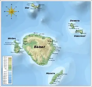
 Die Babarinseln mit Dawera im Nordosten | ||
| Gewässer | Bandasee | |
| Inselgruppe | Babarinseln | |
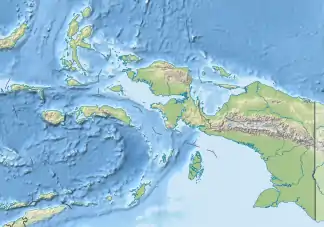
| Geographische Lage | 7° 43′ S, 130° 0′ O | |
| ||
Geographie
Dawera liegt nordöstlich der Hauptinsel Babar. Zusammen mit deren Ostteil und der Insel Masela im Süden und der Nachbarinsel Daweloor bildet Dawera den Subdistrikt (Kecamatan) Babar Timur (Regierungsbezirk der Südwestmolukken, Provinz Maluku).[1]
Orte auf der Insel sind Welora, Ilhar, Lekewaki, Ilikopang, Ilmarang und Letmasa.
Einzelnachweise
This article is issued from Wikipedia. The text is licensed under Creative Commons - Attribution - Sharealike. The authors of the article are listed here. Additional terms may apply for the media files, click on images to show image meta data.
