Corona de Tucson
Corona de Tucson ist ein Census-designated place im Pima County im Süden des US-Bundesstaats Arizona.
| Corona de Tucson | |
|---|---|
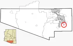 Lage in Arizona | |
| Basisdaten | |
| Staat: | Vereinigte Staaten |
| Bundesstaat: | Arizona |
| County: | Pima County |
| Koordinaten: | 31° 57′ N, 110° 46′ W |
| Zeitzone: | Mountain Standard Time (UTC−7) |
| Einwohner: | 9.240 (Stand: 2020) |
| Fläche: | 6,6 km² (ca. 3 mi²) davon 6,6 km² (ca. 3 mi²) Land |
| Höhe: | 1000 m |
| Postleitzahl: | 85641 |
| Vorwahl: | +1 520 |
| FIPS: | 04-16030 |
| GNIS-ID: | 0037250 |
Weblinks
Commons: Corona de Tucson – Sammlung von Bildern, Videos und Audiodateien
This article is issued from Wikipedia. The text is licensed under Creative Commons - Attribution - Sharealike. The authors of the article are listed here. Additional terms may apply for the media files, click on images to show image meta data.