Concepcion (Iloilo)
Concepcion ist eine philippinische Stadtgemeinde in der Provinz Iloilo. Sie hat 43.159 Einwohner (Zensus 1. August 2015). Im Norden von Concepcion liegt die Insel Pan de Azucar, auf der sich der 606 Meter hohe Mount Manaphaga erhebt und eine markante Landmarke bildet. Weitere Inseln die zum Verwaltungsgebiet der Gemeinde gehören sind Tago-, Sombrero-, Agho-, Bocot-, Bag-o Isi-, Malangabang, Igbon- und Botlog Island.
| Municipality of Concepcion | |||
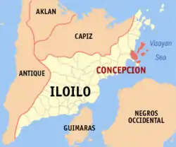
| Lage von Concepcion in der Provinz Iloilo | |||
|---|---|---|---|
 | |||
| Basisdaten | |||
| Region: | Western Visayas | ||
| Provinz: | Iloilo | ||
| Barangays: | 25 | ||
| Distrikt: | 5. Distrikt von Iloilo | ||
| PSGC: | 063015000 | ||
| Einkommensklasse: | 4. Einkommensklasse | ||
| Haushalte: | 6435 Zensus 1. Mai 2000 | ||
| Einwohnerzahl: | 43.159 Zensus 1. August 2015 | ||
| Koordinaten: | 11° 12′ N, 123° 7′ O | ||
| Postleitzahl: | 5013 | ||
| Bürgermeister: | Elizabeth T. Salcedo | ||
| Website: | www.concepcion.gov.ph | ||
| Geographische Lage auf den Philippinen | |||
| |||

Baranggays
Concepcion ist politisch in 25 Baranggays unterteilt.
|
|
This article is issued from Wikipedia. The text is licensed under Creative Commons - Attribution - Sharealike. The authors of the article are listed here. Additional terms may apply for the media files, click on images to show image meta data.