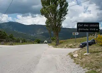
Col des Lèques
Der Col des Lèques ist ein Gebirgspass im französischen Département Alpes-de-Haute-Provence. Er hat eine Scheitelhöhe von 1148 m und liegt an der Route nationale 85, die zwischen Castellane und Barrême als Route Napoléon bekannt ist.
| Col des Lèques | |||
|---|---|---|---|
 | |||
| Himmelsrichtung | West | Ost | |
| Passhöhe | 1148 m | ||
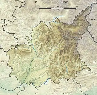
| Département | Alpes-de-Haute-Provence | ||
| Wasserscheide | Asse | Verdon | |
| Talorte | Senez | Castellane | |
| Gebirge | Provenzalische Alpen und Voralpen | ||
| Profil | |||
| Bergwertung | 3 | ||
| Ø-Steigung | 5,1 % (336 m / 6,6 km) | 4,7 % (423 m / 9 km) | |
| Max. Steigung | 8,6 % | 8,4 % | |
| Karte (Alpes-de-Haute-Provence) | |||
| |||
| Koordinaten | 43° 51′ 56″ N, 6° 27′ 50″ O | ||
Weblinks
Commons: Col des Lèques – Sammlung von Bildern, Videos und Audiodateien
This article is issued from Wikipedia. The text is licensed under Creative Commons - Attribution - Sharealike. The authors of the article are listed here. Additional terms may apply for the media files, click on images to show image meta data.