Castillo de Lerés
| Gemeinde Sabiñánigo: Castillo de Lerés | |||
|---|---|---|---|
 Castillo de Lerés | |||
| Wappen | Karte von Spanien | ||
| ? Hilfe zu Wappen |
| ||
| Basisdaten | |||
| Autonome Gemeinschaft: | |||
| Provinz: | Huesca | ||
| Comarca: | Alto Gállego | ||
| Koordinaten | 42° 25′ N, 0° 25′ W | ||
| Einwohner: | 6 (2015)INE | ||
| Postleitzahl: | 22621 | ||
| Ortskennzahl: | 22199001600 | ||


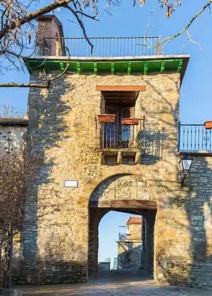
Castillo de Lerés (aragonesisch Castiello de Lerés) ist ein spanischer Ort in der Provinz Huesca der Autonomen Gemeinschaft Aragonien. Castillo de Lerés, im Pyrenäenvorland liegend, gehört zur Gemeinde Sabiñánigo. Der Ort hatte im Jahr 2015 sechs Einwohner.
Geographie
Der Ort liegt etwa 15 Straßenkilometer südlich von Sabiñánigo und ist über die N330 zu erreichen.
Weblinks
- Beschreibung bei aragonesasi.com (spanisch)
Abellada | Abenilla | Acumuer | Aineto | Alavés | Allué | Arguisal | Arraso | Arruaba | Arto | Artosilla | Aspés | Asqués | Asún | Atós Alto | Atós Bajo | Aurín | Bara | Barangua | Belarra | Bentué de Nocito | Bolás | Borrés | Campares | Cañardo | Cartirana | Castiello de Guarga | Castillo de Lerés | Ceresola | Fablo | Fenillosa | Gésera | Gillué | Grasa | Hostal de Ipiés | Ibirque | Ibort | Ipiés | Isín | Isún de Basa | Jabarrella | Laguarta | Lanave | Lárrede | Larrés | Lasaosa | Lasieso | Latas | Latrás | Layés | Molino de Escartín | Molino de Villobas | Ordovés | Orna de Gállego | Osán | Pardinilla | El Puente de Sabiñánigo | Rapún | Sabiñánigo Alto | San Esteban de Guarga | San Román de Basa | Sandiás | Santa María de Perula | Sardas | Sasal | Satué | Secorún | Senegüé | Solanilla | Sorripas | Used | Villacampa | Yéspola