Capitol State Forest
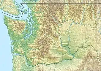
Der Capitol State Forest ist ein 91.650 Acres (371 km²) großer State Forest in den Countys Thurston und Grays Harbor im US-Bundesstaat Washington. Er umfasst Teile des ungewöhnlichen geologischen Objekts Mima Mounds.
Capitol State Forest | ||
.jpg.webp) Biber-Damm und -Stausee am McLane Creek Nature Trail im Capitol State Forest Biber-Damm und -Stausee am McLane Creek Nature Trail im Capitol State Forest | ||
| Lage | Thurston County, Washington, USA | |
| Fläche | 370,9 km² | |
| Geographische Lage | 47° 0′ N, 123° 10′ W | |
| ||
| Meereshöhe | von 183 m bis 810 m | |
| Einrichtungsdatum | 1933[1] | |
Der Capitol State Forest wird vom Washington Department of Natural Resources verwaltet. Der Wald wird mehrfach genutzt. So wird aktiv Holzernte betrieben; darüber hinaus ist der Wald für Geländefahrzeuge, Mountainbikes, Reiter und Wanderer zugänglich.[2]:18 Er wird ungefähr begrenzt vom U.S. Highway 12 im Südwesten, der Interstate 5 im Osten und der Washington State Route 8 im Norden. Die Black Hills gehören zum Großteil zum State Forest. Die Höhen schwanken zwischen 600 ft (183 m) und 2.659 ft (810 m). Etwa 575 mi (925 km) unbefestigter Straßen führen durch den Capitol State Forest.
Nahe seinen Grenzen befinden sich die Städte Olympia, Tumwater, Oakville und McCleary.
Einzelnachweise
- Capitol Forest History. Abgerufen am 5. April 2019.
- Craig Romano: Urban Trails: Olympia: Capitol State Forest/ Shelton/ Harstine Island. The Mountaineers Books, 2017, ISBN 978-1-68051-027-0.
Weblinks
- Offizielle Website vom Washington Department of Natural Resources (englisch)
- Capitol Forest Community Website (englisch)
- Hinweise zum Mountainbiking bei singletracks.com (englisch)
- Friends of Capitol Forest – Website einer Freiwilligenorganisation (englisch)
- Mima Mounds Natural Area Preserve (englisch)
- Capitol State Forest im Geographic Names Information System des United States Geological Survey