Capitol Peak (Thurston County, Washington)
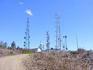
Der Capitol Peak ist ein Berg in den Black Hills im US-Bundesstaat Washington. Er bildet die höchste Erhebung in den Black Hills. Der Capitol Peak liegt im Capitol State Forest. Es gibt eine teilweise befestigte Straße, die Sherman Valley Road, welche bis zum Gipfel führt. Auf dem Gipfel befindet sich eine Liegenschaft, die eine große Anzahl an Mobilfunk- und Radiomasten beherbergt. An klaren Tagen kann man im Westen Elma und das Kernkraftwerk Satsop erkennen; im Osten gibt es eine Aussicht auf Mount Rainier, Mount St. Helens, Mount Adams, den Puget Sound und das Gebiet um Olympia.
| Capitol Peak | ||
|---|---|---|
 | ||
| Höhe | 812 m (North American Vertical Datum of 1988[1]) | |
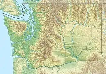
| Lage | Thurston County, Washington, USA | |
| Gebirge | Black Hills | |
| Schartenhöhe | 132 m | |
| Koordinaten | 46° 58′ 22″ N, 123° 8′ 20″ W | |
| ||
Einzelnachweise
- Capitol Peak LOT. National Geodetic Survey. Abgerufen am 23. Januar 2019.
Weblinks
- Capitol Peak (Englisch) In: Geographic Names Information System. United States Geological Survey. Abgerufen am 7. Dezember 2008.
- Capitol Peak, Washington. PeakBagger.com. Abgerufen am 1. Dezember 2008.
This article is issued from Wikipedia. The text is licensed under Creative Commons - Attribution - Sharealike. The authors of the article are listed here. Additional terms may apply for the media files, click on images to show image meta data.