Camp Verde (Arizona)
Camp Verde ist eine US-amerikanische Stadt in Arizona im Yavapai County. Sie hat etwa 12.100 Einwohner (Stand 2020) auf einer Fläche von 110,3 km². Die Stadt liegt an der Interstate 17 und der Arizona State Route 260.
| Camp Verde | |
|---|---|
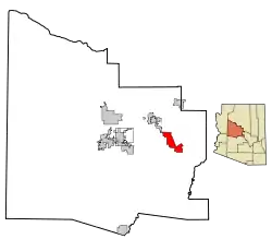 Lage im County und in Arizona | |
| Basisdaten | |
| Staat: | Vereinigte Staaten |
| Bundesstaat: | Arizona |
| County: | Yavapai County |
| Koordinaten: | 34° 34′ N, 111° 51′ W |
| Zeitzone: | Mountain Standard Time (UTC−7) |
| Einwohner: | 12.147 (Stand: 2020) |
| Fläche: | 110,3 km² (ca. 43 mi²) davon 110,2 km² (ca. 43 mi²) Land |
| Höhe: | 959 m |
| Postleitzahl: | 86322 |
| Vorwahl: | +1 928 |
| FIPS: | 04-09690 |
| GNIS-ID: | 0027213 |
| Website: | www.campverde.az.gov |
| Bürgermeister: | Tony Gioia |
Weblinks
Commons: Camp Verde, Arizona – Sammlung von Bildern, Videos und Audiodateien
This article is issued from Wikipedia. The text is licensed under Creative Commons - Attribution - Sharealike. The authors of the article are listed here. Additional terms may apply for the media files, click on images to show image meta data.