Ardnave Point
Ardnave Point (schottisch-gälisch Rubha Aird Nèimh oder Àird an Naoimh) ist die Spitze der Halbinsel Ardnave im Nordwesten der Hebrideninsel Islay. Das Kap liegt an der Atlantikküste gegenüber der Insel Nave an der westlichen Einfahrt des Meeresarmes Loch Gruinart. Administrativ gehört es zu der Council Area Argyll and Bute, beziehungsweise zu der historischen Grafschaft Argyllshire.[1][2]

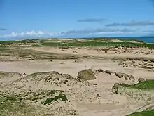
Dünenlandschaft an Ardnave Point

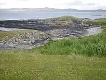
Felsige Küstenlinie
Das Kap ist zuletzt etwa einen Kilometer breit und besteht aus einer sandigen Dünenlandschaft. Die Küstenlinie selbst ist meist felsig.
Einzelnachweise
- Aboyne. In: Francis H. Groome: Ordnance Gazetteer of Scotland: A Survey of Scottish Topography, Statistical, Biographical and Historical. Band 1: (A – Coru). Thomas C. Jack, Grange Publishing Works, Edinburgh u. a. 1882, S. 66.
- Ardnave Point. In: David Munro, Bruce Gittings: Scotland. An Encyclopedia of Places & Landscapes. Collins u. a., Glasgow 2006, ISBN 0-00-472466-6.
This article is issued from Wikipedia. The text is licensed under Creative Commons - Attribution - Sharealike. The authors of the article are listed here. Additional terms may apply for the media files, click on images to show image meta data.