Allan Hills
Die Allan Hills sind eine Gruppe hauptsächlich eisfreier Hügel im ostantarktischen Viktorialand. Sie erstrecken sich über eine Länge von 19 km unmittelbar nordwestlich der Coombs Hills nahe der Kopfenden des Mawson-Gletschers und des Mackay-Gletschers.
| Allan Hills | ||
|---|---|---|
| Höchster Gipfel | Ballance Peak (2330 m) | |
| Lage | Viktorialand, Ostantarktika | |
| Teil des | Transantarktischen Gebirges | |
| ||
| Koordinaten | 76° 43′ S, 159° 40′ O | |
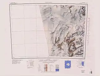
 Karte von 1962, Allan und Coombs Hills in der südlichen Kartenhälfte westlich der Convoy Range Karte von 1962, Allan und Coombs Hills in der südlichen Kartenhälfte westlich der Convoy Range | ||
Die neuseeländische Nordgruppe der Commonwealth Trans-Antarctic Expedition (1955–1958) kartierten sie und benannten die Hügel nach dem neuseeländischen Geologen Robin Sutcliffe Allan (1900–1966) von der University of Canterbury.
Am 27. Dezember 1984 wurde hier der Marsmeteorit ALH 84001 entdeckt.
Weblinks
- Allan Hills im Geographic Names Information System des United States Geological Survey (englisch)
- Allan Hills auf geographic.org (englisch)
- Allan Hills. Foto auf antarcticanz.govt.nz (englisch)
This article is issued from Wikipedia. The text is licensed under Creative Commons - Attribution - Sharealike. The authors of the article are listed here. Additional terms may apply for the media files, click on images to show image meta data.
