Yorkshire Wolds Way
Der Yorkshire Wolds Way ist ein Wanderweg in England. Er wurde am 2. Oktober 1982 als National Trail im Land eingeweiht und führt von Hessle bei Hull in East Riding of Yorkshire nach Norden und Nordosten über die Yorkshire Wolds bis nach Filey, einer Kleinstadt an der Nordseeküste in North Yorkshire. Der Weg ist 127 km lang.
| Yorkshire Wolds Way | |
|---|---|
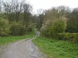 Weg bei Bratt Wood | |
| Daten | |
| Länge | 127 km |
| Lage | nördliches England |
| Markierungszeichen | stilisierte aufrechte weiße Eichel auf braunem Grund |
| Startpunkt | Hessle 53° 43′ 0″ N, 0° 26′ 0″ W |
| Zielpunkt | Filey 54° 13′ 0″ N, 0° 17′ 0″ W |
| Typ | Fernwanderweg |
| Höhenunterschied | 215 m |
| Höchster Punkt | Nahe Thixendale, 215 m |
| Niedrigster Punkt | Filey, Meereshöhe |
| Schwierigkeitsgrad | leicht |
| Jahreszeit | ganzjährig |
| Aussichtspunkte | Humber-Brücke |
Fotografien
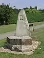 Markierung für den Startpunkt
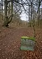 Weg und Grenzstein in East Dale
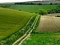 Weg bei North Newbald
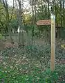 Wegweiser
Literatur
- David Clensy: Walking the Wolds Way. Yorkshire on foot, from Hull to Filey & five East Yorkshire tales. Eigenverlag, s. l. 2007, ISBN 978-1-4303-1019-8.
Weblinks
Commons: Yorkshire Wolds Way – Sammlung von Bildern, Videos und Audiodateien
This article is issued from Wikipedia. The text is licensed under Creative Commons - Attribution - Sharealike. The authors of the article are listed here. Additional terms may apply for the media files, click on images to show image meta data.