Yaquina River
Der Yaquina River ist ein Fluss mit einer Länge von ungefähr 80 Kilometern im US-Bundesstaat Oregon. Er entspringt in der Oregon Coast Range westlich von Corvallis im Siuslaw National Forest zwischen den Countys Benton County und Lincoln County, durchfließt bei Newport die Yaquina Bay und mündet anschließend südlich des Yaquina Bay State Parks in den Pazifischen Ozean.
| Yaquina River | ||
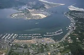 Yaquina Bay mit der Yaquina Bay Bridge und der Mündung des Yaquina River Yaquina Bay mit der Yaquina Bay Bridge und der Mündung des Yaquina River | ||
| Daten | ||
| GNIS-ID | US: 1152700 | |
| Lage | Benton County und Lincoln County, Oregon, USA | |
| Flusssystem | Yaquina River | |
| Quelle | im Siuslaw National Forest in der Oregon Coast Range 44° 44′ 57″ N, 123° 36′ 6″ W | |
| Mündung | zwischen Newport und South Beach in den Pazifik 44° 36′ 44″ N, 124° 1′ 4″ W
| |
| Länge | ca. 80 km | |
This article is issued from Wikipedia. The text is licensed under Creative Commons - Attribution - Sharealike. The authors of the article are listed here. Additional terms may apply for the media files, click on images to show image meta data.