Webber-Nunatak
Der Webber-Nunatak ist ein 495 m hoher Nunatak im westantarktischen Ellsworthland. Er ragt 11 km westlich des Mount Manthe im südlichen Teil des Hudson-Gebirges auf.
| Webber-Nunatak | ||
|---|---|---|
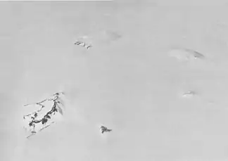
Südlicher Teil des Hudson-Gebirges mit dem Webber-Nunatak links unten (Schrägluftbild von Westen) | ||
| Höhe | 495 m | |
| Lage | Ellsworthland, Westantarktika | |
| Gebirge | Hudson-Gebirge | |
| Koordinaten | 74° 47′ 0″ S, 99° 50′ 0″ W | |
| ||
| Letzte Eruption | 1985 (?) | |

Aufgrund von Satellitenaufnahmen wird vermutet, dass der Webber-Nunatak 1985 Schauplatz eines Vulkanausbruchs gewesen sein könnte. Ergänzende Beobachtungen, die diese Annahme unterstützen, liegen bisher aber nicht vor.[1]
Luftaufnahmen der United States Navy, die im Rahmen der Operation Highjump (1946–1947) erstellt wurden, dienten seiner Kartierung. Das Advisory Committee on Antarctic Names benannte ihn 1968 nach George E. Webber, einem 1967 auf der Byrd-Station tätigen Elektroingenieur.
Weblinks
- Hudson Mountains im Global Volcanism Program der Smithsonian Institution (englisch).
- Antarctica Detail – Webber Nunatak im Geographic Names Information System des United States Geological Survey (englisch).
- Geographical Names – Webber Nunatak, Antarctica. In: geographic.org. (englisch).
Einzelnachweise
- Matthew R. Patrick, John L. Smellie: Synthesis A spaceborne inventory of volcanic activity in Antarctica and southern oceans, 2000–10. In: Antarctic Science. Band 25, Nr. 4, August 2013, ISSN 0954-1020, Antarctica and adjacent islands: Webber Nunatak (Hudson Mountains), S. 482, doi:10.1017/S0954102013000436 (englisch).