Mount Manthe
Mount Manthe ist ein 576 m hoher Berg im westantarktischen Ellsworthland. Er ist der südlichste der drei stark erodierten miozänen Schichtvulkane, die im Wesentlichen das Hudson-Gebirge aufbauen. Er ragt 6 km nordöstlich des Shepherd Dome auf.
| Mount Manthe | ||
|---|---|---|

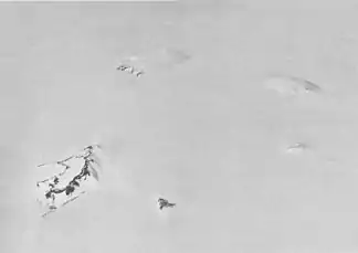
Südlicher Teil des Hudson-Gebirges mit dem Mount Manthe links oberhalb der Bildmitte (Schrägluftbild von Westen) | ||
| Höhe | 576 m | |
| Lage | Ellsworthland, Westantarktika | |
| Gebirge | Hudson-Gebirge | |
| Koordinaten | 74° 47′ 0″ S, 99° 21′ 0″ W | |
| ||
| Typ | Schichtvulkan | |
| Alter des Gesteins | Miozän | |
Luftaufnahmen der United States Navy, die bei der Operation Highjump (1946–1947) entstanden, dienten seiner Kartierung. Das Advisory Committee on Antarctic Names benannte ihn 1968 nach Lawrene L. Manthe (1938–2007), Meteorologe auf der Byrd-Station im antarktischen Winter 1967.
Weblinks
- Hudson Mountains im Global Volcanism Program der Smithsonian Institution (englisch).
- Antarctica Detail – Mount Manthe im Geographic Names Information System des United States Geological Survey (englisch).
- Geographical Names – Manthe, Mount, Antarctica. In: geographic.org. (englisch).
This article is issued from Wikipedia. The text is licensed under Creative Commons - Attribution - Sharealike. The authors of the article are listed here. Additional terms may apply for the media files, click on images to show image meta data.
