Walcott-Firnfeld
Das Walcott-Firnfeld ist ein 560 km² großes Firnfeld in der antarktischen Ross Dependency. Im Transantarktischen Gebirge wird es von den Marshall Mountains, dem Lewis-Kliff und Mount Sirius eingefasst und vom Prebble-Gletscher sowie vom Wyckoff-Gletscher gespeist.
| Walcott-Firnfeld | ||
|---|---|---|
| Lage | Ross Dependency, Antarktika | |
| Gebirge | Transantarktisches Gebirge | |
| Fläche | 560 km² | |
| Koordinaten | 84° 23′ S, 162° 40′ O | |
| ||
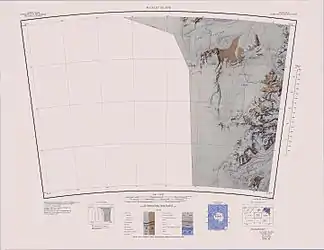 Kartenblatt Buckley Island von 1965 (Neuauflage 1988), WALCOTT NÉVÉ ungefähr in der Mitte der eigentlichen Karte Kartenblatt Buckley Island von 1965 (Neuauflage 1988), WALCOTT NÉVÉ ungefähr in der Mitte der eigentlichen Karte | ||

Die Nordgruppe einer von 1961 bis 1962 durchgeführten Kampagne im Rahmen der New Zealand Geological Survey Antarctic Expedition benannte es nach dem Geologen Richard Irving Walcott (* 1933), dem Leiter der Gruppe.[1]
Weblinks
- Walcott Névé im Geographic Names Information System des United States Geological Survey (englisch)
- Walcott Névé auf geographic.org (englisch)
Einzelnachweise
- John Stewart: Antarctica – An Encyclopedia. Bd. 2, McFarland & Co., Jefferson und London 2011, ISBN 978-0-7864-3590-6, S. 1662 (englisch).
This article is issued from Wikipedia. The text is licensed under Creative Commons - Attribution - Sharealike. The authors of the article are listed here. Additional terms may apply for the media files, click on images to show image meta data.