Ulawa
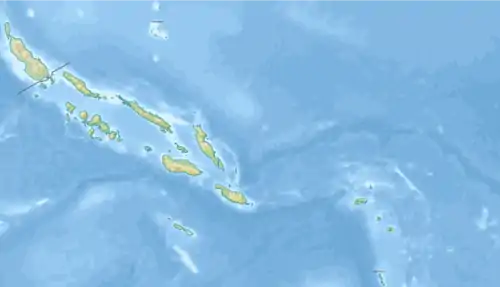
Ulawa ist eine Insel des Inselstaates der Salomonen und Teil der Provinz Makira und Ulawa. Ulawa liegt etwa 40 km südöstlich der nächstgrößeren Insel Maramasike (South Malaita). Die Hauptinsel der Provinz, Makira (früher: San Cristobal), ist etwa 65 km entfernt.
| Ulawa | ||
|---|---|---|
 Strand beim Dorf Lengua, Westküste (1906) | ||
| Gewässer | Pazifischer Ozean | |
| Inselgruppe | Salomon-Inseln | |
| Geographische Lage | 9° 46′ S, 161° 57′ O | |
| ||
| Länge | 17 km | |
| Breite | 5 km | |
| Fläche | 66 km² | |
| Höchste Erhebung | 343 m | |
| Einwohner | 3297 (2009) 50 Einw./km² | |
| Hauptort | Hadja | |
.jpg.webp)
Geographie
Ulawa hat eine Fläche von etwa 66 km² und ungefähr 3.300 Einwohner. Es hat eine hügelige, dicht bewaldete Landschaft. Der höchste Punkt ragt 343 Meter auf. Hauptort ist Hadja an der Westküste.[1]
Die Insel ist etwa seit 750 n. Chr. besiedelt. Der spanische Entdecker Alvaro de Mendaña sichtete Ulawa im Jahr 1568.
Die Bevölkerung der Insel spricht einen Dialekt der austronesischen Sprache Sa'a.
Einzelnachweise
- David Harcombe: Solomon Islands. A travel survival kit. Lonely Planet Publications, Hawthorn, Vic. 1993, ISBN 0-86442-168-0, S. 208.
Weblinks
- Solomonislands.com (Memento vom 3. Dezember 2008 im Internet Archive) (engl.)
This article is issued from Wikipedia. The text is licensed under Creative Commons - Attribution - Sharealike. The authors of the article are listed here. Additional terms may apply for the media files, click on images to show image meta data.