Temotuloto (Nukufetau)
Temotuloto ist eine kleine Riffinsel im Riffsaum des Atolls Nukufetau im Inselstaat Tuvalu.[1][2]
| Temotuloto | ||
|---|---|---|
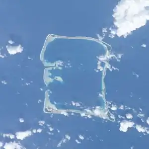 Satellitenbild des Nukufetau-Atolls. | ||
| Gewässer | Pazifischer Ozean | |
| Inselgruppe | Nukulaelae | |
| Geographische Lage | 8° 2′ S, 178° 19′ O | |
| ||

Einzelnachweise
- Map of Nukulaelae Atoll. Tuvaluislands.com.
- British Admiralty Nautical Chart 766 Ellice Islands. 21 March 1872, United Kingdom Hydrographic Office (UKHO) 1893.
- geonames.org.
This article is issued from Wikipedia. The text is licensed under Creative Commons - Attribution - Sharealike. The authors of the article are listed here. Additional terms may apply for the media files, click on images to show image meta data.