Tanaga Island
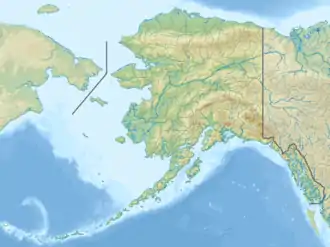
Tanaga Island ist eine Insel im Westen der Andreanof Islands, welche ihrerseits im Südwesten der Aleuten liegen.
| Tanaga Island | ||
|---|---|---|
 Mount Tanaga auf Tanaga Island | ||
| Gewässer | Pazifischer Ozean | |
| Inselgruppe | Aleuten | |
| Geographische Lage | 51° 48′ N, 177° 57′ W | |
| ||
| Länge | 40 km | |
| Breite | 32 km | |
| Fläche | 530 km² | |
| Höchste Erhebung | Mount Tanaga 1806 m | |
| Einwohner | unbewohnt | |
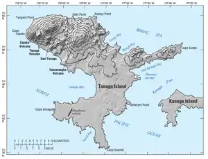 Topographische karte | ||
Die zum US-Bundesstaat Alaska zählende, unbewohnte Insel ist etwa 40 km lang und zwischen 4 und 32 km breit. Im Nordwesten der Insel liegt der 1806 m hohe Vulkan Mount Tanaga, dessen bisher letzter Ausbruch 1914 stattgefunden hat.
Weblinks
Commons: Tanaga Island – Sammlung von Bildern, Videos und Audiodateien
- Information zum Vulkan Mount Tanaga (engl.)
- Tanaga Island im Global Volcanism Program der Smithsonian Institution (englisch)
This article is issued from Wikipedia. The text is licensed under Creative Commons - Attribution - Sharealike. The authors of the article are listed here. Additional terms may apply for the media files, click on images to show image meta data.