Smith Inlet (Viktorialand)
Das Smith Inlet ist eine Bucht an der Pennell-Küste des ostantarktischen Viktorialands. Sie liegt zwischen Kap Moore und Kap Oakeley. In sie hinein mündet die Zunge des Barnett-Gletschers.
| Smith Inlet | ||
|---|---|---|
| Gewässer | Somow-See | |
| Landmasse | Viktorialand, Ostantarktika | |
| Geographische Lage | 70° 59′ 0″ S, 167° 52′ 0″ O | |
| ||
| Breite | 6,5 km | |
| Zuflüsse | Barnett-Gletscher | |
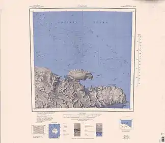 Karte der Pennell-Küste mit dem Smith Inlet (rechts unten) Karte der Pennell-Küste mit dem Smith Inlet (rechts unten) | ||

Entdeckt wurde die Bucht 1841 vom britischen Polarforscher James Clark Ross bei dessen Antarktisexpedition (1839–1843). Ross benannte das Inlet nach Alexander John Smith (1812–1872), Maat auf dem Expeditionsschiff HMS Erebus.
Weblinks
- Smith Inlet im Geographic Names Information System des United States Geological Survey (englisch)
- Smith Inlet auf geographic.org (englisch)
This article is issued from Wikipedia. The text is licensed under Creative Commons - Attribution - Sharealike. The authors of the article are listed here. Additional terms may apply for the media files, click on images to show image meta data.