Sir-Joseph-Banks-Inseln
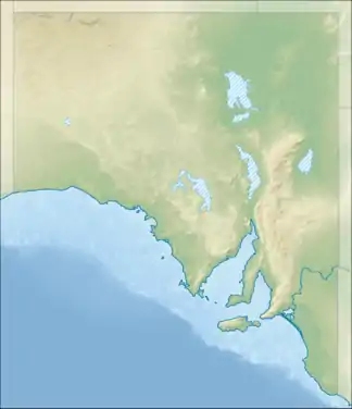
Die Sir-Joseph-Banks-Inseln (auch als Sir Joseph Banks Group bekannt) sind eine unbewohnte Inselgruppe im australischen Bundesstaat South Australia. Die Gruppe liegt im Spencer-Golf (Spencer Gulf) 35 Kilometer nordöstlich der Küstenstadt Port Lincoln.
| Sir-Joseph-Banks-Inseln | ||
|---|---|---|
_(22502006521).jpg.webp) Schrägluftbild der Stickney Island im Süden der Inselgruppe | ||
| Gewässer | Spencer-Golf Indischer Ozean | |
| Geographische Lage | 34° 37′ S, 136° 17′ O | |
| ||
| Anzahl der Inseln | 21 | |
| Hauptinsel | Spilsby Island | |
| Einwohner | unbewohnt | |
Die Inselgruppe besteht aus 21 Inseln bzw. Felsen und erstreckt sich von Nord nach Süd über rund 40 Kilometer Luftlinie, von West nach Ost über etwa 30 Kilometer. Die Inseln, mit Ausnahme der Hauptinsel Spilsby Island im Südosten und der Doppelinsel Reevesby Island im Norden, sind durchweg flach, felsig und nahezu vegetationslos.
Geschichte
Die Inselgruppe wurde 1802 auf einer Entdeckungsreise von Matthew Flinders nach dem Engländer Sir Joseph Banks benannt.
Liste der Inseln
![]() Karte mit allen Koordinaten: OSM | WikiMap
Karte mit allen Koordinaten: OSM | WikiMap
| Inselname | Koordinaten |
|---|---|
| Blyth Island | 34° 34′ S, 136° 18′ O |
| Boucaut Island | 34° 39′ S, 136° 22′ O |
| Howard Rock | 34° 49′ S, 136° 12′ O |
| Dalby Island | 34° 34′ S, 136° 14′ O |
| Dangerous Reef | 34° 49′ S, 136° 13′ O |
| Duffield Island | 34° 39′ S, 136° 19′ O |
| English Island | 34° 38′ S, 136° 12′ O |
| Hareby Island | 34° 35′ S, 136° 18′ O |
| Kirkby Island | 34° 33′ S, 136° 13′ O |
| Langton Island | 34° 36′ S, 136° 15′ O |
| Lusby Island | 34° 33′ S, 136° 16′ O |
| Marum Island | 34° 31′ S, 136° 15′ O |
| Partney Island | 34° 31′ S, 136° 15′ O |
| Reevesby Island | 34° 32′ S, 136° 17′ O |
| Roxby Island | 34° 36′ S, 136° 19′ O |
| Seal Rock | 34° 39′ S, 136° 22′ O |
| Sibsey Island | 34° 39′ S, 136° 11′ O |
| Spilsby Island | 34° 40′ S, 136° 21′ O |
| Stickney Island | 34° 41′ S, 136° 16′ O |
| Smith Rock | 34° 35′ S, 136° 16′ O |
| Winceby Island | 34° 29′ S, 136° 17′ O |
Weblinks
- Private Webseite mit Bildern der Inselgruppe und nautischen Karten
- Sir Joseph Banks Group Conservation park
- Sir Joseph Banks Group Marine Park
This article is issued from Wikipedia. The text is licensed under Creative Commons - Attribution - Sharealike. The authors of the article are listed here. Additional terms may apply for the media files, click on images to show image meta data.