Samuel Point
Der Samuel Point (bulgarisch Носът Самуил Nosat Samuil) ist eine Landspitze an der Südküste der Livingston-Insel im Archipel der Südlichen Shetlandinseln. Sie liegt 9,3 km ostnordöstlich des Botev Point und 5,6 km westsüdwestlich des Aytos Point auf der Südwestseite der Einfahrt zur Brunow Bay.
| Samuel Point | ||
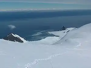 Der Samuel Point (rechts), Bransfieldstraße im Hintergrund | ||
| Geographische Lage | ||
| ||
| Koordinaten | 62° 44′ S, 60° 9′ W | |
| Lage | Livingston-Insel, Südliche Shetlandinseln | |
| Gewässer | Bransfieldstraße | |
| Gewässer 2 | Brunow Bay | |

Britische Wissenschaftler kartierten sie 1968. Die bulgarische Kommission für Antarktische Geographische Namen benannte ihn 2002 nach dem bulgarischen Zaren Samuil (958–1014).
Weblinks
- Samuel Point im Composite Gazetteer of Antarctica (englisch)
This article is issued from Wikipedia. The text is licensed under Creative Commons - Attribution - Sharealike. The authors of the article are listed here. Additional terms may apply for the media files, click on images to show image meta data.