Rivière Obatogamau
Rivière Obatogamau ist ein linker Nebenfluss des Rivière Chibougamau im Südwesten der kanadischen Provinz Québec und im Einzugsgebiet des Rivière Nottaway.
| Rivière Obatogamau | ||
 | ||
| Daten | ||
| Lage | Jamésie, Nord-du-Québec in Québec (Kanada) | |
| Flusssystem | Rivière Nottaway | |
| Abfluss über | Rivière Chibougamau → Rivière Waswanipi → Rivière Nottaway → Hudson Bay | |
| Ursprung | Lacs Obatogamau 49° 36′ 40″ N, 74° 33′ 35″ W | |
| Mündung | Rivière Chibougamau 49° 48′ 20″ N, 75° 30′ 21″ W
| |
| Länge | ca. 70 km[1] | |
| Durchflossene Seen | Lac Muscocho, Lac Keith, Lac à l'Eau Jaune, Lac de la Presqu’île | |
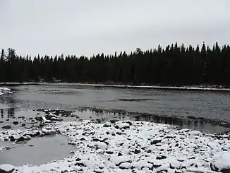
Er bildet den Abfluss des Seensystems der Lacs Obatogamau. Dieses umfasst die Seen Lac La Dauversière, Lac Le Royer, Lac Verneuil und Lac Chevrier. Es liegt etwa 15 km südwestlich des Lac Chibougamau. Der Rivière Obatogamau fließt in westlicher Richtung. Es liegen noch weitere Seen auf seiner Strecke: Lac Muscocho, Lac Keith, Lac à l'Eau Jaune sowie Lac de la Presqu’île. In seinem Unterlauf liegen dann keine nennenswerten Seen. Er erreicht nach einer gesamten Fließstrecke von 70 km den Rivière Chibougamau.[1]
Einzelnachweise
- Commission de toponymie du Québec - Rivière Obatogamau
This article is issued from Wikipedia. The text is licensed under Creative Commons - Attribution - Sharealike. The authors of the article are listed here. Additional terms may apply for the media files, click on images to show image meta data.