Rivière Mingan
Rivière Mingan ist ein 117 km langer Fluss in der Verwaltungsregion Côte-Nord der kanadischen Provinz Québec.
| Rivière Mingan | ||
 | ||
| Daten | ||
| Lage | Côte-Nord in Québec (Kanada) | |
| Flusssystem | Rivière Mingan | |
| Quelle | unweit des Rivière Romaine 51° 1′ 57″ N, 63° 25′ 34″ W | |
| Quellhöhe | 579 m[1] | |
| Mündung | Sankt-Lorenz-Golf 50° 17′ 44″ N, 63° 59′ 21″ W | |
| Mündungshöhe | 0 m[1] | |
| Höhenunterschied | 579 m | |
| Sohlgefälle | 4,9 ‰ | |
| Länge | 117 km[1] | |
| Einzugsgebiet | 2344 km²[1] | |
| Abfluss[1] | MQ |
56 m³/s |
| Rechte Nebenflüsse | Rivière Mingan Nord-Ouest | |
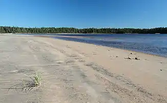
Der Fluss Rivière Mingan fließt in südsüdwestlicher Richtung durch die regionale Grafschaftsgemeinde Minganie zum Sankt-Lorenz-Golf. Dabei nimmt er den von rechts kommenden Rivière Mingan Nord-Ouest auf. Schließlich mündet der Fluss 30 km westlich von Havre-Saint-Pierre ins Meer. An seiner Mündung liegt das Innu-Reservat Mingan.
Der Fluss hat ein Einzugsgebiet von 2344 km² und einen mittleren Abfluss von 56 m³/s.[1]
Weblinks
Commons: Rivière Mingan – Sammlung von Bildern, Videos und Audiodateien
Einzelnachweise
This article is issued from Wikipedia. The text is licensed under Creative Commons - Attribution - Sharealike. The authors of the article are listed here. Additional terms may apply for the media files, click on images to show image meta data.