Rapu-Rapu
Rapu-Rapu ist eine philippinische Stadtgemeinde in der Provinz Albay. Sie hat 36.920 Einwohner (Zensus 1. August 2015).
| Municipality of Rapu-Rapu | |||
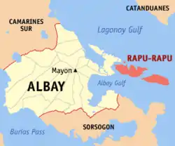
| Lage von Rapu-Rapu in der Provinz Albay | |||
|---|---|---|---|
 | |||
| Basisdaten | |||
| Region: | Bicol-Region | ||
| Provinz: | Albay | ||
| Barangays: | 34 | ||
| Distrikt: | 2. Distrikt von Albay | ||
| PSGC: | 050515000 | ||
| Einkommensklasse: | 4. Einkommensklasse | ||
| Haushalte: | 5591 Zensus 1. Mai 2000 | ||
| Einwohnerzahl: | 36.920 Zensus 1. August 2015 | ||
| Koordinaten: | 13° 11′ N, 124° 8′ O | ||
| Postleitzahl: | 4517 | ||
| Website: | www.rapu-rapu.gov.ph | ||
| Geographische Lage auf den Philippinen | |||
| |||

Sie besteht aus den drei Inseln Guinangayan-, Batan- und Rapu-Rapu Island selbst, auf der sich die Verwaltung der Gemeinde befindet. Die drei Inseln grenzen den Golf von Lagonoy und den Golf von Albay ab.
Baranggays
Rapu-rapu ist politisch unterteilt in 34 Baranggays.
|
|
|
This article is issued from Wikipedia. The text is licensed under Creative Commons - Attribution - Sharealike. The authors of the article are listed here. Additional terms may apply for the media files, click on images to show image meta data.