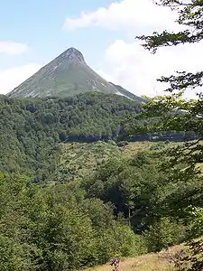
Puy Griou
Der Puy Griou ist einer der höchsten Gipfel der Monts du Cantal im Zentralmassiv. Er liegt auf einer Höhe von 1694 m auf dem Gebiet der Gemeinde Laveissière. Der Berg ist vulkanischen Ursprungs und teilt die Flusstäler von Cère und Jordanne.
 Puy Griou
| Puy Griou | ||
|---|---|---|
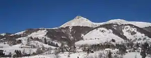
Winteransicht | ||
| Höhe | 1694 m | |
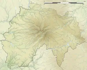
| Lage | Auvergne, Frankreich | |
| Gebirge | Zentralmassiv, Monts du Cantal | |
| Koordinaten | 45° 4′ 49″ N, 2° 42′ 29″ O | |
| ||
| Typ | Staukuppe | |
| Gestein | Phonolith | |
Weblinks
Commons: Puy Griou – Sammlung von Bildern, Videos und Audiodateien
- Infos zum Berg (französisch)
- Fotos und Infos zum Berg (französisch)
This article is issued from Wikipedia. The text is licensed under Creative Commons - Attribution - Sharealike. The authors of the article are listed here. Additional terms may apply for the media files, click on images to show image meta data.