Prescott National Forest
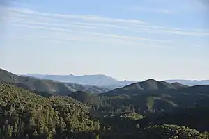
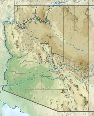
Der Prescott National Forest ist ein etwa 5050 km² (1,25 Millionen Acre)[1] großer National Forest im Zentrum Arizonas in der Nähe der Stadt Prescott in den Vereinigten Staaten. Der Wald liegt in den Bergen südwestlich von Flagstaff und nördlich von Phoenix im Yavapai County, wobei sich ein kleiner Teil (etwa 3,5 Prozent) in das südwestliche Coconino County erstreckt. Die Forstverwaltung befindet sich in Prescott.
Prescott National Forest
IUCN-Kategorie VI – Protected Area with Sustainable use of Natural Resources | ||
 National Forest zwischen Wilhoit und Prescott National Forest zwischen Wilhoit und Prescott | ||
| Lage | Arizona, Vereinigte Staaten | |
| Fläche | 5050 km² | |
| Geographische Lage | 34° 37′ N, 112° 37′ W | |
| ||
| Verwaltung | United States Forest Service | |
Geschichte
Der Wald wurde vom General Land Office am 10. Mai 1898 geschaffen. Er wurde 1906 an den Forest Service übertragen und am 4. März 1907 in einen National Forest umgewandelt. Am 1. Juli 1908 nahm er den Verde National Forest und am 22. Oktober 1934 den Tusayan National Forest auf.[2]
Wilderness Areas
Es gibt acht ausgewiesene Wildnisgebiete mit einer Fläche von über 421 km², die sich ganz oder teilweise innerhalb des Prescott National Forest befinden.
- Apache Creek Wilderness
- Castle Creek Wilderness
- Cedar Bench Wilderness
- Granite Mountain Wilderness
- Juniper Mesa Wilderness
- Pine Mountain Wilderness (größtenteils im Tonto National Forest)
- Sycamore Canyon Wilderness (teilweise im Coconino National Forest und im Kaibab National Forest)
- Woodchute Wilderness
Einzelnachweise
- About the Area, fs.usda.gov, abgerufen am 19. Juli 2019 (englisch)
- Davis, Richard C.: National Forests of the United States. (pdf) Forest History Society, abgerufen am 29. September 2005.
