Port Egmont (Bucht)
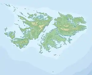
Als Port Egmont wird das im Nordwesten der Falklandinseln gelegene Seegebiet bezeichnet, das von den Inseln Saunders, Keppel und Westfalkland begrenzt wird, und einen natürlichen Hafen bildet.
| Port Egmont | ||
|---|---|---|
| Gewässer | Südatlantik | |
| Landmasse | Saunders Island, Keppel Island und Westfalkland | |
| Geographische Lage | 51° 21′ 0″ S, 60° 0′ 0″ W | |
| ||
| Breite | ca. 10 km | |
| Tiefe | ca. 10 km | |
1765 wurde auf Saunders Island am Port Egmont mit Port Egmont der erste britische Stützpunkt auf den Falklandinseln gegründet.
This article is issued from Wikipedia. The text is licensed under Creative Commons - Attribution - Sharealike. The authors of the article are listed here. Additional terms may apply for the media files, click on images to show image meta data.