Playa Pascual
Playa Pascual ist eine vormals eigenständige Stadt in Uruguay, die seit dem 25. Oktober 2006 zur neugeschaffenen Stadt Ciudad del Plata gehört, deren Barrio sie nun ist.
| Playa Pascual | ||
|---|---|---|
|
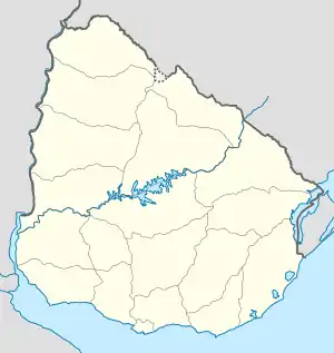
Playa Pascual auf der Karte von Uruguay | ||
| Basisdaten | ||
| Staat | Uruguay | |
| Departamento | San José | |
| Einwohner | 6870 (2011) | |
| Detaildaten | ||
| Höhe | 10 m | |
| Postleitzahl | 80101[1] | |
| Zeitzone | UTC-3 | |
Geographie
Playa Pascual befindet sich auf dem Gebiet des Departamento San José in dessen Sektor 6 am Río de la Plata. Die Stadt liegt westlich von Delta del Tigre y Villas sowie südwestlich von Santa Mónica und südöstlich von Cerámicas del Sur.
Infrastruktur
Durch Playa Pascual führt die Ruta 1.
Einwohner
Die Einwohnerzahl von Playa Pascual beträgt 6.870 (Stand: 2011), davon 3.372 männliche und 3.498 weibliche.[2]
| Jahr | Einwohner |
|---|---|
| 1963 | 380 |
| 1975 | 2.283 |
| 1985 | 2.797 |
| 1996 | 4.584 |
| 2004 | 5.653 |
| 2004 | 6.870 |
Weblinks
- Stadtplan von Playa Pascual (PDF; 118 kB)
Einzelnachweise
- Postleitzahlenverzeichnis der uruguayischen Post, abgerufen am 23. März 2012
- Statistische Daten des Instituto Nacional de Estadística de Uruguay, abgerufen am 28. September 2012
- Statistische Daten des Instituto Nacional de Estadística de Uruguay 1963–1996 (DOC; 148 kB)
- Statistische Daten des Instituto Nacional de Estadística de Uruguay 2004 als XLS-Datei
This article is issued from Wikipedia. The text is licensed under Creative Commons - Attribution - Sharealike. The authors of the article are listed here. Additional terms may apply for the media files, click on images to show image meta data.
