Pic la Selle
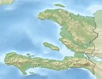
Der Pic la Selle (auch: Morne La Selle) ist mit 2674 m der höchste Berg Haitis und der vierthöchste Berg der Karibik. Er liegt in der Chaîne de la Selle, etwa 40 km ostsüdöstlich der Hauptstadt Port-au-Prince, und ist Teil des La Visite National Parks.
| Pic la Selle | ||
|---|---|---|
| Höhe | 2674 m | |
| Lage | Haiti / Karibik | |
| Gebirge | Chaîne de la Selle | |
| Koordinaten | 18° 21′ 37″ N, 71° 58′ 36″ W | |
| ||
| Besonderheiten | Höchster Berg Haitis | |
An dem Berg entspringt der Rivière Grise, der mit seiner Länge von etwa 290 km zu den fünf längsten Flüssen des Staates gehört.
Weblinks
- Pic la Selle auf Peakbagger.com (englisch)
This article is issued from Wikipedia. The text is licensed under Creative Commons - Attribution - Sharealike. The authors of the article are listed here. Additional terms may apply for the media files, click on images to show image meta data.
