Paugussett State Forest
Paugussett State Forest ist ein State Forest im US-Bundesstaat Connecticut auf dem Gebiet der Gemeinde Newtown.[3] Er besteht aus zwei getrennten Arealen an Stauseen des Housatonic River. Der obere (nordwestliche) Teil des Forsts umfasst ca. 320 ha (800 acres)[4] am Westufer des Lake Lillinonah. Er bietet Möglichkeiten, Boot zu fahren und zu wandern auf dem blue-blazed Lillinonah Trail. Am gegenüberliegenden Ufer befindet sich der George Waldo State Park. Der untere (südöstlich gelegene) Block umfasst ca. 490 ha (1200 acres)[4] am Westufer des Lake Zoar. Wandermöglichkeiten bietet hier der Zoar Trail. Auf dem gegenüberliegenden Ufer liegen Kettletown State Park und Jackson Cove Town Park.[5]
Paugussett State Forest | ||
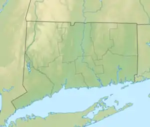
| Lage | Newtown, Fairfield County, USA[1] | |
| Fläche | 7,88 km2[2] | |
| Geographische Lage | 41° 25′ N, 72° 12′ W | |
| ||
| Einrichtungsdatum | ~1940 | |
| Verwaltung | Dept. of Energy & Environmental Protection, Connecticut State | |
Siehe auch
Einzelnachweise
- Geographic Names Information System. United States Geological Survey.
- State Parks and Forests: Finanzierung, Mitarbeitergewinnung und Empfehlungen. (PDF)
- Paugussett State Forest. In: State Parks and Forests. Connecticut Department of Energy and Environmental Protection. Abgerufen am 30. September 2013.
- Connecticut State Forests Seedling Letterbox Series - Clues for Paugussett State Forest. In: State Parks and Forests. Connecticut Department of Energy and Environmental Protection. Abgerufen am 30. September 2013.
- U.S. Geological Survey. The National Map
Weblinks
- Paugussett State Forest Connecticut Department of Energy and Environmental Protection
- Paugussett State Forest Upper Block Map Connecticut Department of Energy and Environmental Protection
- Paugussett State Forest Lower Block Map Connecticut Department of Energy and Environmental Protection
- Lillinonah Trail Connecticut Museum Quest
- Paugussett State Forest Berkshire Hiking
This article is issued from Wikipedia. The text is licensed under Creative Commons - Attribution - Sharealike. The authors of the article are listed here. Additional terms may apply for the media files, click on images to show image meta data.