Nugent Island
Nugent Island ist die nördlichste Insel der Kermadecinseln und damit das nördlichste Gebiet in Neuseeland. Es liegt nordöstlich von Neuseeland, ist ungefähr kreisförmig und hat einen Durchmesser von etwa 100 Metern. Nugent Island gehört zur Gruppe der Inseln rund um Raoul Island.
| Nugent Island | |
|---|---|
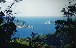 Blick von Raoul Island auf Nugent und die größeren Nachbarinseln Meyer Islands und Dayrell Island, Nugent hinter den Bäumen auf der linken Seite | |
| Gewässer | Pazifischer Ozean |
| Inselgruppe | Kermadecinseln |
| Geographische Lage | 29° 13′ 54″ S, 177° 52′ 9″ W |
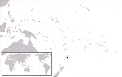 Lage von Nugent Island | |
| Länge | 100 m |
| Breite | 100 m |
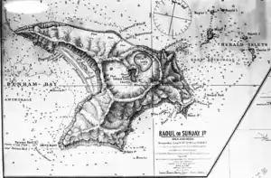 Nugent Island im Nordosten der Seekarte von 1887 | |
Das Gestein der Insel ist ungefähr 600.000 bis 1,4 Millionen Jahre alt; es besteht aus gehobener und gekippter Kissenlava und entstand bei submarinen Vulkanausbrüchen.[1]
Einzelnachweise
This article is issued from Wikipedia. The text is licensed under Creative Commons - Attribution - Sharealike. The authors of the article are listed here. Additional terms may apply for the media files, click on images to show image meta data.