North Barnard Islands
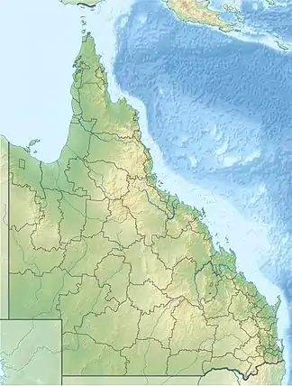
Die North Barnard Islands[1] sind eine unbewohnte Inselgruppe im Nordosten des australischen Bundesstaats Queensland. Die aus fünf Inseln bestehende Gruppe liegt nahe der Küste, etwa sechs Kilometer nordöstlich des Küstenorts Cowley Beach.
| North Barnard Islands | ||
|---|---|---|
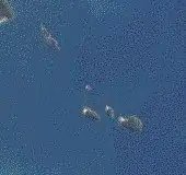 NASA-Satellitenbild der Inselgruppe | ||
| Gewässer | Korallenmeer | |
| Geographische Lage | 17° 40′ S, 146° 11′ O | |
| ||
| Anzahl der Inseln | 5 | |
| Hauptinsel | Kent Island | |
| Einwohner | unbewohnt | |
Inseln
![]() Karte mit allen Koordinaten: OSM | WikiMap
Karte mit allen Koordinaten: OSM | WikiMap
| Inselname | Aliasname | Koordinaten | Fläche |
|---|---|---|---|
| Lindquist Island | 17° 39′ S, 146° 10′ O | … | |
| Bresnahan Island | 17° 40′ S, 146° 10′ O | … | |
| Jessie Island | 17° 40′ S, 146° 10′ O | … | |
| Hutchinson Island | 17° 40′ S, 146° 10′ O | … | |
| Kent Island | 17° 41′ S, 146° 11′ O | … |
Nationalpark
Zusammen mit den sieben Kilometer südlich gelegenen South Barnard Islands bilden die North Barnard Islands den Barnard Island Group National Park[2].
Einzelnachweise
- geonames.org
- Barnard Island Group National Park. In: parks.des.qld.gov.au. Abgerufen am 8. Dezember 2020 (englisch).
This article is issued from Wikipedia. The text is licensed under Creative Commons - Attribution - Sharealike. The authors of the article are listed here. Additional terms may apply for the media files, click on images to show image meta data.