Ninigo-Inseln
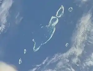
Die Ninigo-Inseln (deutsch: Schachbrettinseln[1]) sind eine Gruppe von Atollen der Westlichen Inseln des Bismarck-Archipels. Administrativ gehören die Atolle zur Provinz Manus in Papua-Neuguinea.
| Ninigo-Inseln | |
|---|---|
 NASA-Photo der Ninigo-Inseln | |
| Gewässer | Pazifischer Ozean |
| Geographische Lage | 1° 16′ S, 144° 16′ O |
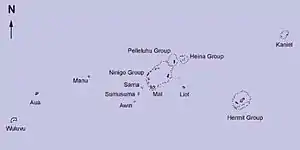
 Karte von Ninigo-Inseln | |
| Anzahl der Inseln | 8 Atolle |
| Hauptinsel | Ninigo-Atoll |
| Einwohner | 972 (2000) |
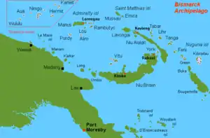
 Karte der Westlichen Inseln des Bismarck-Archipels, mit den Ninigo-Inseln im Zentrum | |
Geographie
Die Inselgruppe liegt ca. 1000 km nordöstlich von Papua-Neuguineas Hauptstadt Port Moresby und 255 km nordwestlich von der Provinzhauptstadt Manus entfernt. Die Gruppe besteht aus den 3 größeren Atollen:
- Ninigo, ca. 34 km lang und 18 km breit, mit der Hauptinsel Mal, sowie ca. 30 kleineren Motus (darunter vier bewohnte: Pihon, Amik, Mal, Lau);
- Pelleluhu, ca. 9 km lang und 8 km breit, mit der Hauptinsel Pelleluhu und 13 weiteren Motus;
- Heina, ca. 5 km nordöstlich von Pelleluhu gelegen, bestehend aus 6 Motus;
und den 5 kleineren Atollen:
- Liot, Sama, Sumusama, Awin und Manu
| Atoll/Insel | Koordinaten | Fläche | Einwohner 2000 |
|---|---|---|---|
| Ninigo | ... | ... | 633 |
| Pelleluhu | ... | ... | - |
| Heina | ... | ... | - |
| Liot | ... | ... | 68 |
| Sama | ... | ... | 202 |
| Sumasuma | ... | ... | - |
| Awin | ... | ... | 51 |
| Manu | ... | ... | 18 |
| Ninigo Islands | ... | ... | 972 |
Einzelnachweise
- Deutsches Koloniallexikon. Hrsg. von Heinrich Schnee. - Leipzig: Quelle & Meyer 1920. - 3 Bde.
Weblinks
- Detaillierte Beschreibung auf Oceandots.Com (engl.) (Memento vom 23. Dezember 2010 im Internet Archive)
- Karten der Ninigo-Gruppe (engl.)
- The Full Story of Ninigo
- The Wuvulu Web Site: Geography of the Western Islands, Geographical Names in the Western Islands (mit systematischer Auflistung aller Inseln jedes Atolls, einschl. Namensvarianten)
This article is issued from Wikipedia. The text is licensed under Creative Commons - Attribution - Sharealike. The authors of the article are listed here. Additional terms may apply for the media files, click on images to show image meta data.