Nemunėlis
Der Nemunėlis (lettisch Mēmele) ist ein Fluss in Litauen und Lettland.
| Nemunėlis Mēmele | ||
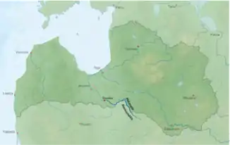
 Karte | ||
| Daten | ||
| Lage | Litauen, Lettland | |
| Flusssystem | Lielupe | |
| Abfluss über | Lielupe → Rigaischer Meerbusen | |
| Quelle | Kreis Rokiškis, Litauen 55° 54′ 36″ N, 25° 36′ 9″ O | |
| Quellhöhe | ca. 132 m | |
| Vereinigung mit | Mūsa (Mūša) zur Lielupe bei Bauska (Lettland) 56° 24′ 9″ N, 24° 9′ 26″ O | |
| Mündungshöhe | ca. 7 m | |
| Höhenunterschied | ca. 125 m | |
| Sohlgefälle | ca. 0,65 ‰ | |
| Länge | 191 km | |
| Einzugsgebiet | 4047 km² | |
| Abfluss | MNQ MQ HHQ |
30 m³/s 95 m³/s 341 m³/s |
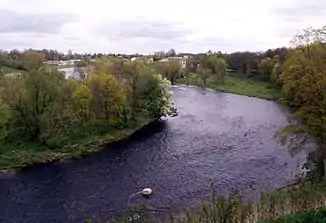
 Die Mēmele bei Bauska Die Mēmele bei Bauska | ||
Er entspringt im Lušna-See bei Rokiškis. Der Fluss bildet für 76 km die natürliche Grenze zwischen Litauen und Lettland. Bei Bauska fließt er mit der Mūša (lettisch Mūsa), die ebenfalls in Litauen entspringt, zusammen. Ab hier heißt der Fluss dann Lielupe, „Großfluss“. Im Mittelteil hat der Fluss ein breites tieferes Tal ausgebildet, ansonsten verläuft er durch flache Niederungen.
Ab Panemunis ist der Fluss mit dem Boot befahrbar.
Zuflüsse sind unter anderem Beržuona, Apašča, Vīžona, Dienvidsusēja (114 km), Viesīte (59 km), Nereta (25 km), und Rīkonu strauts (18 km).
Weblinks
Commons: Nemunėlis – Sammlung von Bildern, Videos und Audiodateien
This article is issued from Wikipedia. The text is licensed under Creative Commons - Attribution - Sharealike. The authors of the article are listed here. Additional terms may apply for the media files, click on images to show image meta data.