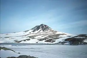
Mount Searle
Mount Searle ist ein nach britischen Angaben 536 m (bzw. 1760 Fuß) hoher Berg auf Horseshoe Island vor der Fallières-Küste des Grahamlands auf der Antarktischen Halbinsel. Er ragt zwischen der Sally Cove und der Gaul Cove auf.
| Mount Searle | ||
|---|---|---|
 | ||
| Höhe | 536 m | |
| Lage | Horseshoe Island, Antarktische Halbinsel | |
| Koordinaten | 67° 48′ 48″ S, 67° 14′ 12″ W | |
| ||
Das UK Antarctic Place-Names Committee benannte ihn im Jahr 1959 nach dem britischen Geographen Derek Searle (1928–2003), der diesen Berg für den Falkland Islands Dependencies Survey während seines Aufenthalts auf Horseshoe Island zwischen 1955 und 1956 vermessen hatte.
Weblinks
- Mount Searle im Geographic Names Information System des United States Geological Survey (englisch)
- Mount Searle auf geographic.org (englisch)
This article is issued from Wikipedia. The text is licensed under Creative Commons - Attribution - Sharealike. The authors of the article are listed here. Additional terms may apply for the media files, click on images to show image meta data.
