Motherway Island
Motherway Island ist eine kleine Felseninsel im Archipel der Windmill-Inseln vor der Budd-Küste des ostantarktischen Wilkeslands. Sie liegt 325 m nördlich der Insel Peterson Island nahe dem südlichen Ende des Archipels.
| Motherway Island | ||
|---|---|---|
| Gewässer | Vincennes Bay | |
| Inselgruppe | Windmill-Inseln | |
| Geographische Lage | 66° 27′ S, 110° 31′ O | |
| ||
| Höchste Erhebung | 82 m | |
| Einwohner | unbewohnt | |
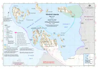 Karte der südlichen Windmill-Inseln mit Motherway Island (Mitte) | ||

Die Insel wurde anhand von Luftaufnahmen der US-amerikanischen Operation Highjump (1946–1947) vom Februar 1947 kartiert. Das Advisory Committee on Antarctic Names benannte sie 1963 nach Paul Thomas Motherway (1927–2002), Mitglied einer von zwei Einheiten der United States Navy zur Erstellung von Luftaufnahmen und Fotografien vor Ort während der Operation Windmill (1947–1948) im Januar 1948.
Weblinks
- Motherway Island im Geographic Names Information System des United States Geological Survey (englisch)
- Motherway Island auf geographic.org (englisch)
- Motherway Island im Composite Gazetteer of Antarctica (englisch)
This article is issued from Wikipedia. The text is licensed under Creative Commons - Attribution - Sharealike. The authors of the article are listed here. Additional terms may apply for the media files, click on images to show image meta data.