Mansfield Point
Der Mansfield Point ist eine Landspitze an der Südküste von Coronation Island im Archipel der Südlichen Orkneyinseln. Sie markiert die Ostseite der Einfahrt zur Norway Bight.
| Mansfield Point | ||
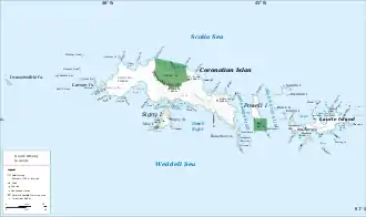
 Karte von Coronation Island (Mitte) mit der Norway Bight und dem Mansfield Point | ||
| Geographische Lage | ||
| ||
| Koordinaten | 60° 38′ S, 45° 44′ W | |
| Lage | Coronation Island (Südliche Orkneyinseln) | |
| Gewässer | Weddell-Meer | |
| Gewässer 2 | Norway Bight | |
Teilnehmer der britischen Discovery Investigations kartierten die Landspitze im Jahr 1933. Der Falkland Islands Dependencies Survey (FIDS) nahm zwischen 1948 und 1949 Vermessungen vor. Das UK Antarctic Place-Names Committee benannte sie am 31. März 1955 nach Arthur Walter Mansfield (* 1926), Meteorologe des FIDS in Grytviken im Jahr 1952 und im Jahr darauf als Leiter der Station des FIDS auf Signy Island tätig.
Weblinks
- Mansfield Point im Geographic Names Information System des United States Geological Survey (englisch)
- Mansfield Point auf geographic.org (englisch)
This article is issued from Wikipedia. The text is licensed under Creative Commons - Attribution - Sharealike. The authors of the article are listed here. Additional terms may apply for the media files, click on images to show image meta data.
