Liste von Vulkanen in Kenia

Dies i​st eine Liste v​on Vulkanen i​n Kenia, d​ie während d​es Quartärs mindestens einmal a​ktiv waren.

Bild Name Vulkantyp Letzte Eruption Höhe [m] Geokoordinaten
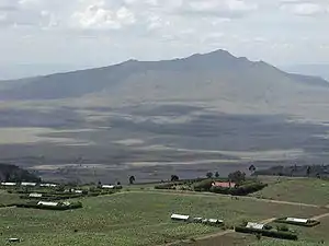
The Barrier Schildvulkan 1921 1032 !502.3166675536.566667502° 19′ 00″ N, 036° 34′ 00″ O
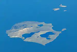
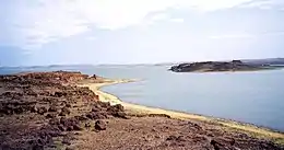
Central Island (Crocodile Island) Tuffkegel unbekannt 550 !503.5000005536.041667503° 30′ 00″ N, 036° 02′ 30″ O
Chyulu Hills Vulkanfeld 1855 ± 5 Jahre 2188 !497.3166675537.883333502° 41′ 00″ S, 037° 53′ 00″ O
Dukana[1] Vulkanfeld[1] unbekannt 1067[1] !504.0833335537.416667504° 05′ 00″ N, 037° 25′ 00″ O[1]
Elmenteita Badlands Schlacken- und Aschenkegel unbekannt 2126 !499.4833335536.266667500° 31′ 00″ S, 036° 16′ 00″ O
Emuruangogolak Schildvulkan 1910 ± 50 Jahre 1328 !501.5000005536.333333501° 30′ 00″ N, 036° 20′ 00″ O
Mount Homa Komplexer Vulkan unbekannt 1751 !499.6166675534.500000500° 23′ 00″ S, 034° 30′ 00″ O
Korosi Schildvulkan unbekannt 1446 !500.7666675536.116667500° 46′ 00″ N, 036° 07′ 00″ O
Mount Longonot Schichtvulkan 1863 ± 5 Jahre 2776 !499.0855565536.446389500° 54′ 52″ S, 036° 26′ 47″ O
Mount Marsabit Schildvulkan unbekannt 1707 !502.3166675537.966667502° 19′ 00″ N, 037° 58′ 00″ O
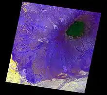
Menengai-Krater Caldera ca. 6050 v. Chr. 2278 !499.8000005536.066667500° 12′ 00″ S, 036° 04′ 00″ O
Namarunu Schildvulkan 6550 v. Chr. ± 1000 Jahre 817 !501.9833335536.433333501° 59′ 00″ N, 036° 26′ 00″ O
North Island (Turkana-See) Tuffkegel unbekannt 520 !504.0666675536.050000504° 04′ 00″ N, 036° 03′ 00″ O
Nyambeni Hills Schildvulkan unbekannt 750 !500.2333335537.866667500° 14′ 00″ N, 037° 52′ 00″ O
Ol Doinyo Eburru Komplexer Vulkan unbekannt 2856 !499.3500005536.216667500° 39′ 00″ S, 036° 13′ 00″ O
Ol Kokwe Schildvulkan unbekannt 1130 !500.6166675536.075000500° 37′ 00″ N, 036° 04′ 30″ O
Olkaria Komplexer Vulkan 1770 ± 50 Jahre 2434 !499.0958335536.291667500° 54′ 15″ S, 036° 17′ 30″ O
Paka Schildvulkan 7550 v. Chr. ± 1000 Jahre 1697 !500.9166675536.183333500° 55′ 00″ N, 036° 11′ 00″ O
Segererua Plateau Vulkanfeld unbekannt 699 !501.5666675537.900000501° 34′ 00″ N, 037° 54′ 00″ O
Silali Schildvulkan 5050 v. Chr. ± 1000 Jahre 1528 !501.1500005536.233333501° 09′ 00″ N, 036° 14′ 00″ O
South Island (Turkana-See) Schichtvulkan 1888 800 !502.6333335536.600000502° 38′ 00″ N, 036° 36′ 00″ O
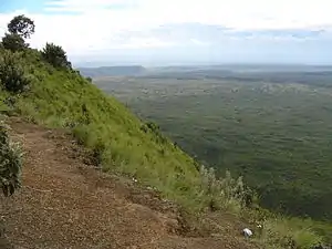
Suswa Schildvulkan unbekannt 2356 !498.8250005536.350000501° 10′ 30″ S, 036° 21′ 00″ O

Siehe auch

Einzelnachweise

Hauptquelle: Smithsonian Institution - Global Volcanism Program: Worldwide Holocene Volcano a​nd Eruption Information

sowie:

  1. Mega Basalt Field im Global Volcanism Program der Smithsonian Institution (englisch)
This article is issued from Wikipedia. The text is licensed under Creative Commons - Attribution - Sharealike. The authors of the article are listed here. Additional terms may apply for the media files, click on images to show image meta data.