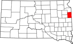
Liste der Einträge im National Register of Historic Places im Deuel County (South Dakota)
Die Liste der Einträge im National Register of Historic Places im Deuel County in South Dakota führt alle Bauwerke und historischen Stätten im Deuel County auf, die in das National Register of Historic Places aufgenommen wurden.[1]
Legende
| NRHP | Historic Place |
|---|---|
| HD | Historic District |
Aktuelle Einträge
| [2] | Name[3] | Bild | Eintragsdatum | Lage | Ort | Beschreibung |
|---|---|---|---|---|---|---|
| 1 | Deuel County Courthouse and Jail | Deuel County Courthouse and Jail |
1976 ID-Nr. 76001730 |
4th Street, West 44° 45′ 17″ N, 96° 41′ 25″ W |
Clear Lake | |
| 2 | East Highland Lutheran Church | 2000 ID-Nr. 00000120 |
Rund 10 km östlich von Brandt 44° 40′ 29″ N, 96° 31′ 31″ W |
Norden Township | 1915 im neugotischen Stil errichtete lutherische Kirche | |
| 3 | First National Bank Building | 1977 ID-Nr. 77001242 |
Abseits des SD 22 44° 47′ 34″ N, 96° 27′ 24″ W |
Gary | ||
| 4 | Herrick Barn | 2005 ID-Nr. 05000628 |
Rund 800 m nordwestlich der Kreuzung der County Road 310 mit dem SD 101 44° 47′ 43″ N, 96° 28′ 1″ W |
Gary | ||
| 5 | Hoffman Barn | 2005 ID-Nr. 05001188 |
16937 482 Avenue 44° 55′ 47″ N, 96° 33′ 31″ W |
südlich von Revillo | ||
| 6 | Kliegle Garage | 1999 ID-Nr. 99001213 |
Chicago Avenue 44° 52′ 41″ N, 96° 51′ 2″ W |
Goodwin | ||
| 7 | Odd Fellows Building | 1976 ID-Nr. 76001731 |
Main Street 44° 47′ 34″ N, 96° 27′ 24″ W |
Gary | 1898 errichtetes Klub- und Versammlungshaus | |
| 8 | Old Cochrane Road Bridge | 1993 ID-Nr. 93001268 |
County Road 516 44° 42′ 3″ N, 96° 29′ 15″ W |
Norden Township | ||
| 9 | South Dakota Dept. of Transportation Bridge No. 20-153-210 | 1993 ID-Nr. 93001286 |
Brücke über den Cobb Creek 44° 40′ 27″ N, 96° 34′ 28″ W |
östlich von Brandt | ||
| 10 | South Dakota School for the Blind | 1988 ID-Nr. 88000570 |
Coteau Street Ecke 3rd Street 44° 47′ 46″ N, 96° 27′ 18″ W |
Gary |
Siehe auch
Einzelnachweise
- Auszug aus dem National Register of Historic Places - Deuel County Abgerufen am 9. Juli 2013
- Die Nummerierung in dieser Listenspalte ist an der vom National Park Service vorgelegten Reihenfolge der Einträge orientiert; die Farben unterscheiden verschiedene Schutzgebietstypen des National Park Systems mit landesweiter Bedeutung (z. B. National Historic Landmarks) von den sonstigen Einträgen im National Register of Historic Places.
- National Register Information System. In: National Register of Historic Places. National Park Service. Abgerufen am 9. Juli 2010.
National Register of Historic Places in South Dakota
Aurora | Beadle | Bennett | Bon Homme | Brookings | Brown | Brule | Buffalo | Butte | Campbell | Charles Mix | Clark | Clay | Codington | Corson | Custer | Davison | Day | Deuel | Dewey | Douglas | Edmunds | Fall River | Faulk | Grant | Gregory | Haakon | Hamlin | Hand | Hanson | Harding | Hughes | Hutchinson | Hyde | Jackson | Jerauld | Jones | Kingsbury | Lake | Lawrence | Lincoln | Lyman | Marshall | McCook | McPherson | Meade | Mellette | Miner | Minnehaha | Moody | Pennington | Perkins | Potter | Roberts | Sanborn | Shannon | Spink | Stanley | Sully | Todd | Tripp | Turner | Union | Walworth | Yankton | Ziebach