Liste der Berge in Victoria
Die Liste der Berge in Victoria gibt eine Übersicht der Berge im australischen Bundesstaat Victoria.
Berge (Auswahl)
Legende: H = Höhe (m) über dem Meeresspiegel; K = Koordinaten (Klick auf das Symbol öffnet das Kartenmenü.)

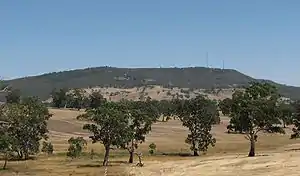
Hanging Rock (718)
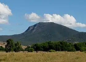
Mount Alexander (744 m)
Höchster Berg in Victoria:
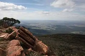
Mount Bogong (1986 m)
Mount Bogong (1986 m)
Mount Buller (1805 m)
Mount Tambo (1430 m)
Mount William (1167 m)
| Name | Lage | H | K | Bemerkung/en |
|---|---|---|---|---|
| Basalt Hill | Australische Alpen Victorian Alps Bogong High Plains | 1684 | ||
| Ben Nevis | Mount Cole State Forest | 960 | [1] | |
| Briggs Bluff | Australische Alpen Grampians National Park | 420 | ||
| Brumby Point | Australische Alpen Nunniong Plateau | |||
| Burnt Top Hill | Australische Alpen Victorian Alps Buller-Howitt Region | 1167 | [2] | |
| Camels Hump | 1011 | |||
| Cathedral Peak | Australische Alpen Victorian Alps Cathedral Range | 845 | ||
| Cleft Peak | Australische Alpen Victorian Alps Cobberas Range | |||
| Durd-Durd | Australische Alpen Grampians National Park | 1167 | ||
| Eagles Peaks | Australische Alpen Victorian Alps Buller-Howitt Region | 1446 | ||
| Green Hill | Australische Alpen Victorian Alps Cathedral Range | |||
| Hanging Rock | 718 | * auch: Mount Diogenes * durch Intraplattenvulkanismus entstanden | ||
| Hollands Knob | Australische Alpen Victorian Alps Bogong High Plains Hollands Knob Reference Area | 1813 | ||
| Hollow Mountain | Australische Alpen Grampians National Park | |||
| Jones Ridge | 124 | |||
| King Billy No. 1 | Australische Alpen Victorian Alps Buller-Howitt Region | 1716 | ||
| King Billy No. 2 | Australische Alpen Victorian Alps Buller-Howitt Region | 1696 | ||
| Lake Mountain | Australische Alpen Cathedral Range Yarra-Ranges-Nationalpark | 1480 | ||
| Little Mount Tambo | Australische Alpen | 1277 | ||
| Long Hill | Australische Alpen Victorian Alps Moroka-Tarli Karng Region | 1290 | ||
| Marum Point | 1819 | |||
| Middle Peak | Australische Alpen Victorian Alps Cobberas Range | |||
| Moscow Peak | Australische Alpen Victorian Alps Cobberas Range | |||
| Mount Abrupt | Australische Alpen Grampians National Park | 825 | [3] | |
| Mount Alexander | Mount Alexander Regional Park | 744 | ||
| Mount Arapiles | 369 | |||
| Mount Baw Baw | Australische Alpen Baw-Baw-Plateau | 1567 | ||
| Mount Beckworth | 629 | [4] | ||
| Mount Beenak | 745 | |||
| Mount Benambra | Australische Alpen | 1480 | ||
| Mount Bogong | Australische Alpen Victorian Alps | 1986 | höchster Berg in Victoria | |
| Mount Buangor | 987 | |||
| Mount Buggery | Australische Alpen Victorian Alps Buller-Howitt Region | 1583 | ||
| Mount Buggery | Australische Alpen | 1153 | Wangaratta | |
| Mount Buller | Australische Alpen Victorian Alps Buller-Howitt Region | 1805 | ||
| Mount Buninyong | Newer Volcanics Province | 745 | ||
| Mount Clear | Australische Alpen Victorian Alps Buller-Howitt Region | 1695 | ||
| Mount Cobberas No. 1 | Australische Alpen Victorian Alps Cobberas Range | 1833 | ||
| Mount Cobberas No. 2 | Australische Alpen Victorian Alps Cobberas Range | [5] | ||
| Mount Cobbler | Australische Alpen Victorian Alps Buller-Howitt Region | 1628 | ||
| Mount Cooper | 137 | |||
| Mount Cope | Australische Alpen Victorian Alps Bogong High Plains | 1837 | ||
| Mount Corhanwarrabul | 628 | |||
| Mount Cravensville | Mount Cravensville Natural Features and Scenis Reserve | 1358 | [6] | |
| Mount Dandenong | 633 | |||
| Mount Despair | Australische Alpen Victorian Alps Buller-Howitt Region | 1460 | ||
| Mount Disappointment | Hume Range | 800 | ||
| Mount Difficult | Australische Alpen Grampians National Park | 806 | ||
| Mount Dom Dom | Australische Alpen | 740 | ||
| Mount Donna Buang | Australische Alpen Yarra-Ranges-Nationalpark | 1250 | ||
| Mount Eccles | Mount-Eccles-Nationalpark (Budj Bim National Park) | 178 | * inaktiver Vulkan | |
| Mount Elephant | Kanawinka Geopark | 240 | * Vulkanischer Schlackenkegel | |
| Mount Elizabeth | 941 | |||
| Mount Ellery | östliches Gippsland Errinundra-Nationalpark Errinundra-Plateau | 1280 | ||
| Mount Fainter North | Australische Alpen Victorian Alps Bogong High Plains | 1817 | [7] | |
| Mount Fainter South | Australische Alpen Victorian Alps Bogong High Plains | 1883 | ||
| Mount Feathertop | Australische Alpen Victorian Alps Alpine-Nationalpark | 1922 | zweithöchster Berg in Victoria | |
| Mount Franklin | 648 | |||
| Mount Gibbo | Australische Alpen | 1750 | ||
| Mount Gorrin | Langi Ghiran State Park | 738 | [8] | |
| Mount Hopeless | ||||
| Mount Horsfall | 1130 | |||
| Mount Hotham | Australische Alpen Victorian Alps Bogong High Plains | 1862 | * vulkanischen Ursprungs | |
| Mount Howitt | Australische Alpen Victorian Alps Buller-Howitt Region | 1742 | ||
| Mount Jim | Australische Alpen Victorian Alps Bogong High Plains | 1818 | ||
| Mount Kaye | Coopracambra-Nationalpark | 998 | ||
| Mount Kincade | ||||
| Mount Koonika | Australische Alpen Victorian Alps Buller-Howitt Region | 1594 | ||
| Mount Langi Ghiran | Langi Ghiran State Park | 980 | [9] | |
| Mount Leura | Newer Volcanics Province | 313 | * Vulkankrater | |
| Mount Ligar | Australische Alpen Victorian Alps Moroka-Tarli Karng Region | 1165 | ||
| Mount Loch | Australische Alpen Victorian Alps Bogong High Plains | 1865 | ||
| Mount Magdala | Australische Alpen Victorian Alps Buller-Howitt Region | 1725 | ||
| Mount Matlock | Australische Alpen | 1377 | ||
| Mount McDonald | Australische Alpen Victorian Alps Buller-Howitt Region | 1620 | ||
| Mount McKay | Australische Alpen Victorian Alps Bogong High Plains | 1849 | ||
| Mount Napier | Mount Napier State Park | 440 | * einer der jüngsten Vulkane Australiens | |
| Mount Nelse | Australische Alpen Victorian Alps Bogong High Plains | 1882 | ||
| Mount Nelse North | Australische Alpen Victorian Alps Bogong High Plains | 1884 | ||
| Mount Nelse West | Australische Alpen Victorian Alps Bogong High Plains | 1893 | ||
| Mount Noorat | Newer Volcanics Province | 313 | * vermutlich der größte Vulkankrater Australiens, der nicht mit Wasser gefüllt ist | |
| Mount Puckapunyal | Puckapunyal Military Training Area | 413 | [10] | |
| Mount Reynard | Australische Alpen Victorian Alps Moroka-Tarli Karng Region | 1705 | ||
| Mount Riddell | 805 | |||
| Mount Ritchie | 1259 | |||
| Mount Rosea | Australische Alpen Grampians National Park | 1006 | ||
| Mount Selma | Australische Alpen | 1456 | ||
| Mount Selwyn | Australische Alpen | 1411 | ||
| Mount Speculation | Australische Alpen Victorian Alps Buller-Howitt Region | 1666 | ||
| Mount St. Gwinear | Australische Alpen | 1509 | ||
| Mount Stapylton | Australische Alpen Grampians National Park | 518 | ||
| Mount Stirling | Australische Alpen Victorian Alps Buller-Howitt Region | 1749 | ||
| Mount Strathbogie | 1045 | |||
| Mount Tambo | Australische Alpen | 1430 | ||
| Mount Tamboritha | Australische Alpen Victorian Alps Moroka-Tarli Karng Region | 1509 | ||
| Mount Tarrengower | 556 | |||
| Mount Terrible | Australische Alpen | 1325 | ||
| Mount Thackeray | Australische Alpen Grampians National Park | 979 | ||
| Mount Toorongo | 1247 | |||
| Mount Torbreck | Australische Alpen | 1516 | ||
| Mount Typo | ||||
| Mount Useful | Australische Alpen | 1435 | ||
| Mount Warrenheip | 714 | |||
| Mount Warrenmang | 526 | |||
| Mount Warrnambool | 216 | |||
| Mount Wellington | Australische Alpen Victorian Alps Moroka-Tarli Karng Region | 1634 | ||
| Mount William | Australische Alpen Grampians National Park | 1167 | auch: Mount Duwil | |
| Mount Wills | Australische Alpen | 1755 | ||
| Mount Wycheproof | Terrick Terrick Range | 148 | ||
| Mount Zero | Australische Alpen Grampians National Park | 364 | ||
| Pine Mountain | Australische Alpen Burrowa-Pine-Mountain-Nationalpark | 1062 | ||
| Red Man Bluff | Australische Alpen Grampians National Park | 1017 | ||
| Spion Kopje | Australische Alpen Victorian Alps Bogong High Plains | 1837 | ||
| South Peak | Wilsons Promontory | 379 | * südlichster Gipfel Kontinetal-Victorias | |
| Sugarloaf Peak | Australische Alpen Victorian Alps Cathedral Range | 923 | ||
| Sundial Peak | Australische Alpen Grampians National Park | 802 | ||
| The Bluff | Australische Alpen Victorian Alps Buller-Howitt Region | 1725 | ||
| The Fortress | Australische Alpen Grampians National Park | 875 | ||
| The Horn | Australische Alpen Mount Buffalo National Park | 1723 | * auch Mount Buffalo | |
| The Hump | Australische Alpen Mount Buffalo National Park | 1695 | ||
| The Viking | Australische Alpen Victorian Alps Buller-Howitt Region | 1519 | ||
| You Yangs | 364 | auch: Flinders Peak |
Weblinks
Commons: Berge in Victoria – Sammlung von Bildern, Videos und Audiodateien
Einzelnachweise
- Lage und Höhe des Ben Nevis bei www.openstreetmap.org; abgerufen am 21. Februar 2019.
- Lage und Höhe des Burnt Top Hill bei www.openstreetmap.org; abgerufen am 19. Februar 2019.
- Lage und Höhe des Mount Abrupt bei www.openstreetmap.org; abgerufen am 22. Februar 2019.
- Lage und Höhe des Mount Beckworth bei www.openstreetmap.org; abgerufen am 22. Februar 2019.
- Lage des Mount Cobberas No. 2 bei www.openstreetmap.org; abgerufen am 19. Februar 2019.
- Lage und Höhe des Mount Cravensville bei www.openstreetmap.org; abgerufen am 22. Februar 2019.
- Höhe des Mount Fainter North bei www.openstreetmap.org; abgerufen am 19. Februar 2019.
- Lage und Höhe des Mount Gorrin bei www.openstreetmap.org; abgerufen am 21. Februar 2019.
- Lage und Höhe des Mount Langi Ghiran bei www.openstreetmap.org; abgerufen am 21. Februar 2019.
- Lage und Höhe des Mount Puckapunyal bei www.openstreetmap.org; abgerufen am 22. Februar 2019.
This article is issued from Wikipedia. The text is licensed under Creative Commons - Attribution - Sharealike. The authors of the article are listed here. Additional terms may apply for the media files, click on images to show image meta data.