Leuchtturm Hraunhafnartangi
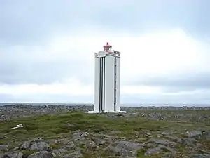
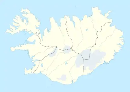
Der Leuchtturm Hraunhafnartangi (isländisch Hraunhafnartangaviti) ist der nördlichste Leuchtturm Islands. Er steht rund 800 Meter südlich des Polarkreises.
| Leuchtturm Hraunhafnartangi Hraunhafnartangaviti | ||
|---|---|---|
 | ||
| Ort: | Melrakkaslétta Norðurland eystra, | |
| Lage: | nordwestlich von Raufarhöfn | |
| Geographische Lage: | 66° 32′ 7,1″ N, 16° 1′ 15,6″ W Seekarte | |
| ||
| Feuerhöhe: | 21 m | |
| Bauart: | Beton | |
| Bauform: | quadratischer Grundriss | |
| Kennung: | Mo.(N)W.R.30s ▄▄▄ ▄ | |
| Sektorenfeuer: | R: 000°-105° W: 105°-290° R: 290°-330°. | |
| Nenntragweite weiß: | 10 sm (18,5 km) | |
| Nenntragweite rot: | 7 sm (13 km) | |
| Bauzeit: | bis 1951 | |
| Listeneinträge | ||
| UKHO: | L 4699 | |
| NGA: | 18844 | |
| ARLHS: | ICE-005 | |
Lage und Beschreibung
Der Leuchtturm befindet sich an der Nordostküste Islands, etwa 10 km nordwestlich von Raufarhöfn, der nördlichsten Ortschaft auf dem isländischen Festland.[1] Der Leuchtturm hat einen quadratischen Grundriss, ist 19 Meter hoch und aus Beton gebaut.[2] Das Laternenhaus ist rot.
Kennung
Die Kennung ist ein langer und ein kurzer Blitz, welcher alle 30 Sekunden erscheint. Der Blitz ist je nach Richtung vom Leuchtturm weiß oder rot.[2]
Weblinks
- Foghorn Publishing: Hraunhafnartangi Light. In: Lighthouse Explorer Database. Abgerufen am 11. November 2021.
Einzelnachweise
- Raufarhofn, the northernmost village in Iceland, midnight sun and northern lights. 27. Mai 2010, abgerufen am 3. Januar 2021.
- Russ Rowlett: Lighthouses of Northern Iceland (Englisch) In: The Lighthouse Directory. University of North Carolina at Chapel Hill.
This article is issued from Wikipedia. The text is licensed under Creative Commons - Attribution - Sharealike. The authors of the article are listed here. Additional terms may apply for the media files, click on images to show image meta data.
