Keim Peak
Der Keim Peak ist ein markanter und 2045 m hoher Felsgipfel im ostantarktischen Viktorialand. Er ragt aus dem südlichen Ausläufer des Pomerantz-Tafellands in den Usarp Mountains auf.
| Keim Peak | ||
|---|---|---|
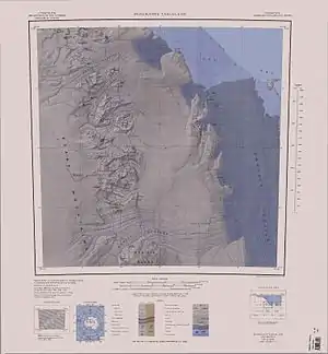
Topographische Kare mit dem Keim Peak (untere Kartenhälfte) | ||
| Höhe | 2045 m | |
| Lage | Viktorialand, Ostantarktika | |
| Gebirge | Usarp Mountains, Transantarktisches Gebirge | |
| Koordinaten | 70° 44′ 0″ S, 159° 52′ 0″ O | |
| ||

Kartografisch erfasst wurde das Gebiet durch Vermessungen des United States Geological Survey und mithilfe von Luftaufnahmen der United States Navy von 1960 bis 1962. Das Advisory Committee on Antarctic Names benannte den Berg 1964 nach Mike B. Keim, Fotograf für Luftaufnahmen der Flugstaffel VX-6 im Dienst der US-Navy in Viktorialand von 1962 bis 1963, der nochmals zwischen 1963 und 1964 in Antarktika tätig war.
Weblinks
- Keim Peak im Geographic Names Information System des United States Geological Survey (englisch)
- Keim Peak auf geographic.org (englisch)
This article is issued from Wikipedia. The text is licensed under Creative Commons - Attribution - Sharealike. The authors of the article are listed here. Additional terms may apply for the media files, click on images to show image meta data.