Pomerantz-Tafelland
Das Pomerantz-Tafelland ist ein 15 km langes und 2290 m hoch gelegenes Tafelland im ostantarktischen Viktorialand. Es liegt etwa 25 km nordwestlich der Daniels Range in den Usarp Mountains.
| Pomerantz-Tafelland | ||
|---|---|---|
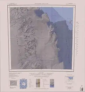 Topografische Karte des Pomerantz-Tafellands Topografische Karte des Pomerantz-Tafellands | ||
| Lage | Viktorialand, Ostantarktika | |
| Teil der | Usarp Mountains | |
| ||
| Koordinaten | 70° 38′ S, 159° 50′ O | |

Das Gebiet wurde vom United States Geological Survey und mithilfe von Luftaufnahmen der United States Navy von 1960 bis 1962 kartografisch erfasst. Das Advisory Committee on Antarctic Names benannte es 1964 nach dem US-amerikanischen Physiker Martin A. Pomerantz (1916–2008), Leiter der Barthol Research Foundation an der University of Delaware und Vorsitzender des US-Komitees zum Internationalen Jahres der ruhigen Sonne, das 1959 bis 1960 und 1961 bis 1962 Untersuchungen zur kosmischen Strahlung im Gebiet des McMurdo-Sunds durchführte.
Weblinks
- Pomerantz Tableland im Geographic Names Information System des United States Geological Survey (englisch)
- Pomerantz Tableland auf geographic.org (englisch)