Ilhéu Caroço
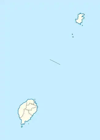
Ilhéu Caroço (engl. Carocho Islet, früher auch Ilheu Boné de Joquei oder Dutchman’s Cap) ist eine kleine, unbewohnte und zum westafrikanischen Staat São Tomé und Príncipe gehörende Insel im Golf von Guinea. Sie befindet sich 2,9 km südöstlich der Ponta do Pico Negro, der südöstlichen Landspitze Príncipes, und gehört zur gleichnamigen Provinz Príncipe.
| Ilhéu Caroço | ||
|---|---|---|
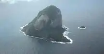 Schrägluftbild der Insel von Nordwesten | ||
| Gewässer | Golf von Guinea | |
| Geographische Lage | 1° 30′ 47″ N, 7° 25′ 47″ O | |
| ||
| Länge | 840 m | |
| Breite | 550 m | |
| Fläche | 40 ha | |
| Höchste Erhebung | 305 m | |
Die Insel ist etwa 840 Meter lang und 550 Meter breit. Dies ergibt eine Fläche von gut vierzig Hektar. Sie erhebt sich steil aus dem Meer und erreicht eine Höhe von 305 Metern.[1]
Die Insel gehört zur Kamerunlinie und ist vulkanischen Ursprungs. Sie wird von Phonolithen aufgebaut[2], die ein Alter um 5,4 Millionen Jahren aufweisen.[3]
Einzelnachweise
- Sailing Directions (Enroute), Pub. 123: Southwest Coast of Africa (PDF). Sailing Directions. United States National Geospatial-Intelligence Agency. 2017, S. 75
- J. G. Fitton & D. J. Hughes (1977): Petrochemistry of the Volcanic Rocks of the Island of Principe, Gulf of Guinea. Contributions to Mineralogy and Petrology 64, 257–272.
- H. M. Dunlop & J. G. Fitton (1979): A K-Ar and Sr-Isotopic Study of the Volcanic Rocks of the Island of Principe, West Africa - Evidence for Mantle Heterogeneity Beneath the Gulf of Guinea. Contributions to Mineralogy and Petrology 71, 125–131.
This article is issued from Wikipedia. The text is licensed under Creative Commons - Attribution - Sharealike. The authors of the article are listed here. Additional terms may apply for the media files, click on images to show image meta data.