Iceberg Bay
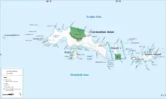
Die Iceberg Bay (englisch für Eisbergbucht, in Argentinien gleichbedeutend Bahía Témpano) ist eine 5 km breite Bucht an der Südküste von Coronation Island im Archipel der Südlichen Orkneyinseln. Sie liegt zwischen dem Kap Hansen und dem Olivine Point.
| Iceberg Bay | ||
|---|---|---|
 Karte von Coronation Island (Mitte) mit der Iceberg Bay Karte von Coronation Island (Mitte) mit der Iceberg Bay | ||
| Gewässer | Orwell Bight | |
| Landmasse | Coronation Island, Südliche Orkneyinseln | |
| Geographische Lage | 60° 39′ 0″ S, 45° 32′ 0″ W | |
| ||
| Breite | 5 km | |
Der schottische Seefahrer Matthew Brisbane (1787–1833), Kapitän der Beaufroy of London während der dritten Antarktisfahrt James Weddells (1822–1824), nahm im Jahr 1823 eine grobe Kartierung der Südküste von Coronation Island vor und benannte die Bucht deskriptiv.
Weblinks
- Iceberg Bay im Geographic Names Information System des United States Geological Survey (englisch)
- Iceberg Bay auf geographic.org (englisch)
This article is issued from Wikipedia. The text is licensed under Creative Commons - Attribution - Sharealike. The authors of the article are listed here. Additional terms may apply for the media files, click on images to show image meta data.
