Humaston Brook State Park
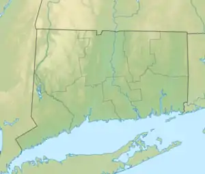
Humaston Brook State Park ist ein State Park im US-Bundesstaat Connecticut auf dem Gebiet der Gemeinde Litchfield.
Humaston Brook State Park | ||
| Lage | Litchfield, Litchfield County, USA[1] | |
| Fläche | 0,57 km2[2] | |
| Geographische Lage | 41° 42′ N, 73° 6′ W | |
| ||
| Einrichtungsdatum | 1994 | |
| Verwaltung | Dept. of Energy & Environmental Protection, Connecticut State | |
Geographie
Der State Park umfasst einen Teil des Oberlaufs des Humaston Brooks und einen kurzen Abschnitt des Turner Brooks, die sich südlich des Parks vereinigen und bald darauf in den Northfield Brook münden, der dem Naugatuck River zufließt. Der Humaston Brook bildet den Northfield Pond im Süden des Parks, der die Hauptattraktion darstellt.[3] Im Norden liegt als nächstgelegenes Schutzgebiet der Topsmead State Forest und etwa 4 km weiter südlich der Black Rock State Park.
Freizeitaktivitäten
Neben Wandern bietet der Park Möglichkeiten zum Angeln am Northfield Pond.[4]
Siehe auch
Einzelnachweise
- Geographic Names Information System. United States Geological Survey.
- State Parks and Forests: Finanzierung, Mitarbeitergewinnung und Empfehlungen. (PDF)
- U.S. Geological Survey. The National Map
- Humaston Brook State Park. In: State Parks and Forests. Connecticut Department of Energy and Environmental Protection. Abgerufen am 5. Februar 2013.
Weblinks
- Humaston Brook State Park Connecticut Department of Energy and Environmental Protection
- ConnecticutAtoZ
This article is issued from Wikipedia. The text is licensed under Creative Commons - Attribution - Sharealike. The authors of the article are listed here. Additional terms may apply for the media files, click on images to show image meta data.
