Hombori Tondo
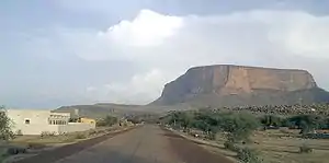
Der Hombori Tondo ist mit 1153 Meter der höchste Berg Malis. Der Tafelberg liegt in direkter Nachbarschaft des Ortes Hombori an der Straße von Gao nach Mopti und bildet das nördliche Ende des Bandiagara-Felsmassivs.
| Hombori Tondo | ||
|---|---|---|
 | ||
| Höhe | 1153 m | |
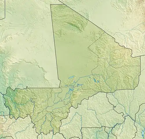
| Lage | Mali, Westafrika | |
| Gebirge | Bandiagara-Felsmassiv / Homboriberge | |
| Koordinaten | 15° 15′ 26″ N, 1° 40′ 8″ W | |
| ||
| Typ | Tafelberg | |
Weblinks
Commons: Hombori Tondo – Sammlung von Bildern, Videos und Audiodateien
This article is issued from Wikipedia. The text is licensed under Creative Commons - Attribution - Sharealike. The authors of the article are listed here. Additional terms may apply for the media files, click on images to show image meta data.