Hollin Island
Hollin Island ist eine rund 1,5 km lange Insel im Archipel der Windmill-Inseln vor der Budd-Küste des ostantarktischen Wilkeslands. Sie liegt nördlich von Midgley Island.
| Hollin Island | ||
|---|---|---|
| Gewässer | Vincennes Bay | |
| Inselgruppe | Windmill-Inseln | |
| Geographische Lage | 66° 19′ 16″ S, 110° 24′ 0″ O | |
| ||
| Länge | 1,5 km | |
| Höchste Erhebung | 49 m | |
| Einwohner | unbewohnt | |
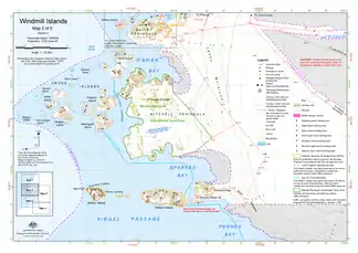 Karte der mittleren Windmill-Inseln mit Hollin Island (links der Mitte) | ||

Die Insel wurde anhand von Luftaufnahmen der US-amerikanischen Operation Highjump (1946–1947) erstmals kartiert. Das Advisory Committee on Antarctic Names benannte sie 1963 nach dem US-amerikanischen Glaziologen John Trevor Hollin, der 1958 auf der Wilkes-Station tätig war.
Weblinks
- Hollin Island im Geographic Names Information System des United States Geological Survey (englisch)
- Hollin Island auf geographic.org (englisch)
This article is issued from Wikipedia. The text is licensed under Creative Commons - Attribution - Sharealike. The authors of the article are listed here. Additional terms may apply for the media files, click on images to show image meta data.