Hōkūkano-ʻUalapuʻe Complex
Der Hōkūkano-ʻUalapuʻe Complex[1] ist eine prähistorische Fundstätte in Hawaii.
| Hōkūkano-ʻUalapuʻe Complex | |||
|---|---|---|---|
| National Register of Historic Places | |||
| National Historic Landmark
| |||
| |||
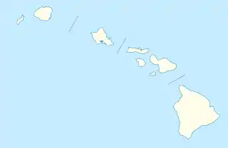
| Lage | Molokaʻi, Maui County, Hawaii | ||
| Koordinaten | 21° 3′ 43,7″ N, 156° 49′ 47,5″ W | ||
| NRHP-Nummer | 66000304 | ||
| Daten | |||
| Ins NRHP aufgenommen | 15. Oktober 1966 | ||
| Als NHL deklariert | 29. Dezember 1962 | ||
Er liegt auf mehreren Grundstücken neben der Hawaii Route 45 auf der Insel Molokaʻi.[2] Der Hōkūkano-ʻUalapuʻe Complex enthält zwei Fischweiher und sechs Heiaus, das sind hawaiische Tempel. Am 29. Dezember 1962 wurde der Hōkūkano-ʻUalapuʻe Complex eine National Historic Landmark.[3] Am 15. Oktober 1966 wurde er als Historic District in das National Register of Historic Places aufgenommen.[4]
Weblinks
- Fotosammlung im National Register of Historic Places. In: Datenbank des National Register of Historic Places. National Park Service, 27. Dezember 2007, abgerufen am 20. September 2014 (englisch, PDF 7,4 MB).
Einzelnachweise
- Hōkūkano in Hawaiian Dictionaries; ʻUalapuʻe in Hawaiian Dictionaries
- National Register of Historic Places Inventory: Nomination Form
- Listing of National Historic Landmarks by State: Hawaii. National Park Service, abgerufen am 21. Juli 2019.
- Hōkūkano-ʻUalapuʻe Complex im National Register Information System. National Park Service, abgerufen am 9. August 2017.
This article is issued from Wikipedia. The text is licensed under Creative Commons - Attribution - Sharealike. The authors of the article are listed here. Additional terms may apply for the media files, click on images to show image meta data.