Grindle Rock
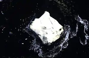
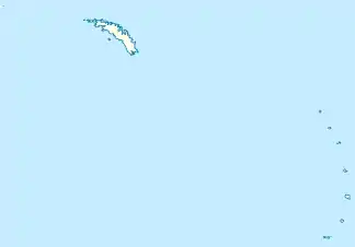
Der Grindle Rock ist ein 215 m hoher und markanter Klippenfelsen im Archipel der Südlichen Sandwichinseln. Er ragt 1,7 km westlich von Bristol Island aus dem Meer. Weiter westlich liegen der Wilson Rock und der Freezland Rock.
| Grindle Rock | ||
|---|---|---|
 NASA Terra ASTER image von Bristol Island, mit Grindle Rock nahe der Westspitze | ||
| Gewässer | Scotiasee | |
| Inselgruppe | Südliche Sandwichinseln | |
| Geographische Lage | 59° 1′ 5″ S, 26° 39′ 29″ W | |
| ||
| Länge | 640 m | |
| Breite | 610 m | |
| Fläche | 30 ha | |
| Höchste Erhebung | 213 m | |
| Einwohner | unbewohnt | |
Der britische Seefahrer James Cook entdeckte ihn im Jahr 1775. Eine neuerliche Kartierung nahmen Wissenschaftler der britischen Discovery Investigations im Jahr 1930 vor. Sie benannten ihn nach Gilbert Edmund Augustine Grindle (1869–1934), Permanent Under-Secretary im Colonial Office.
Weblinks
- Grindle Rock im Geographic Names Information System des United States Geological Survey (englisch)
- Grindle Rock auf geographic.org (englisch)
This article is issued from Wikipedia. The text is licensed under Creative Commons - Attribution - Sharealike. The authors of the article are listed here. Additional terms may apply for the media files, click on images to show image meta data.
